 |    |
  |  |
0 Comments
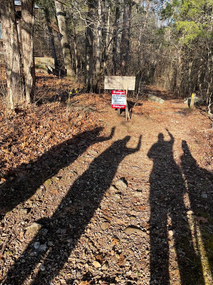
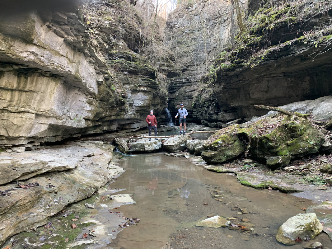
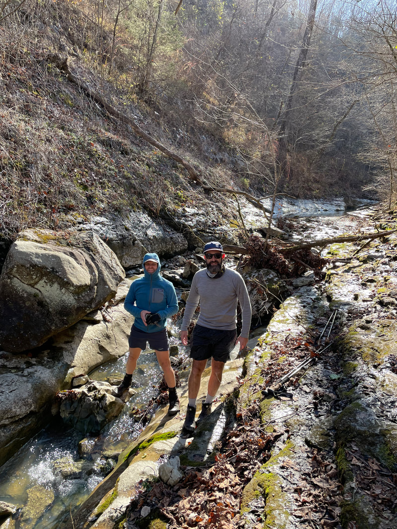
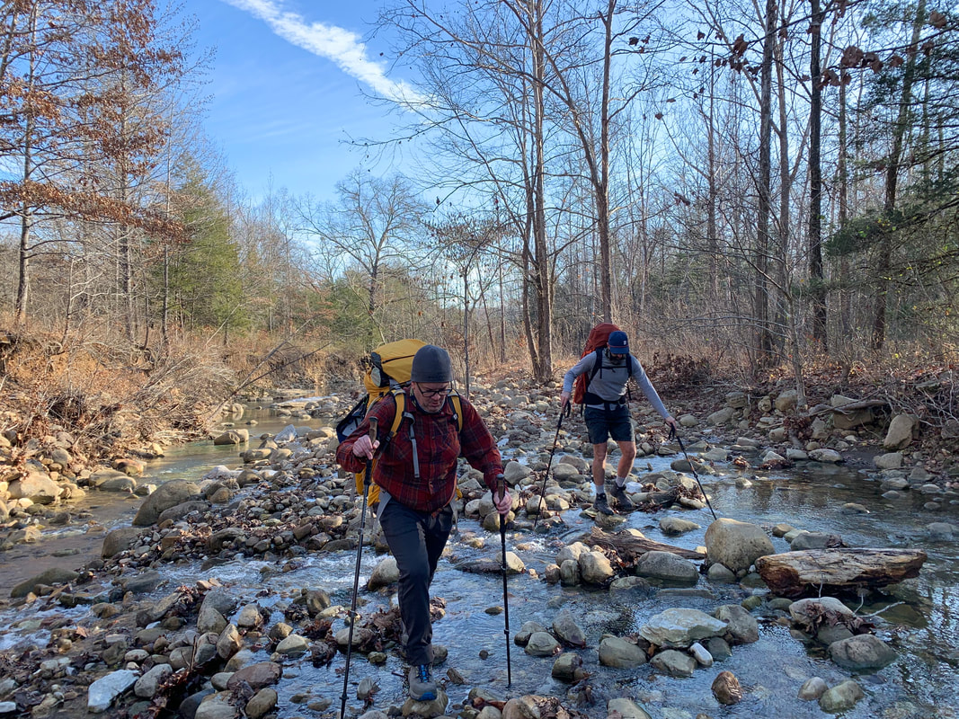
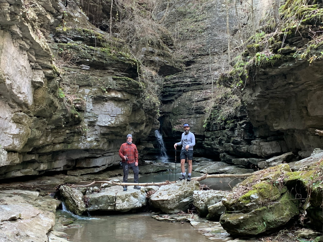
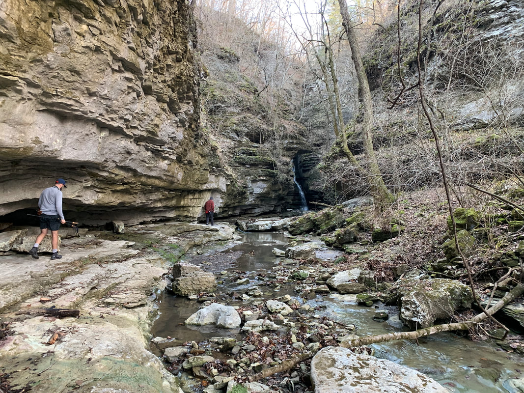
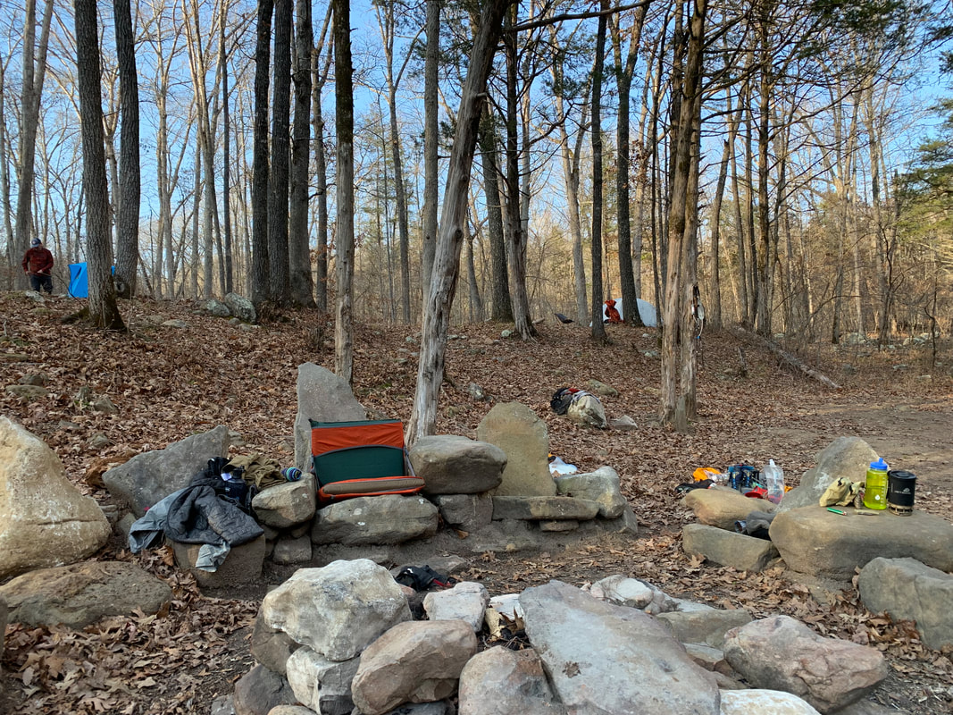
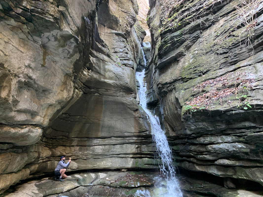
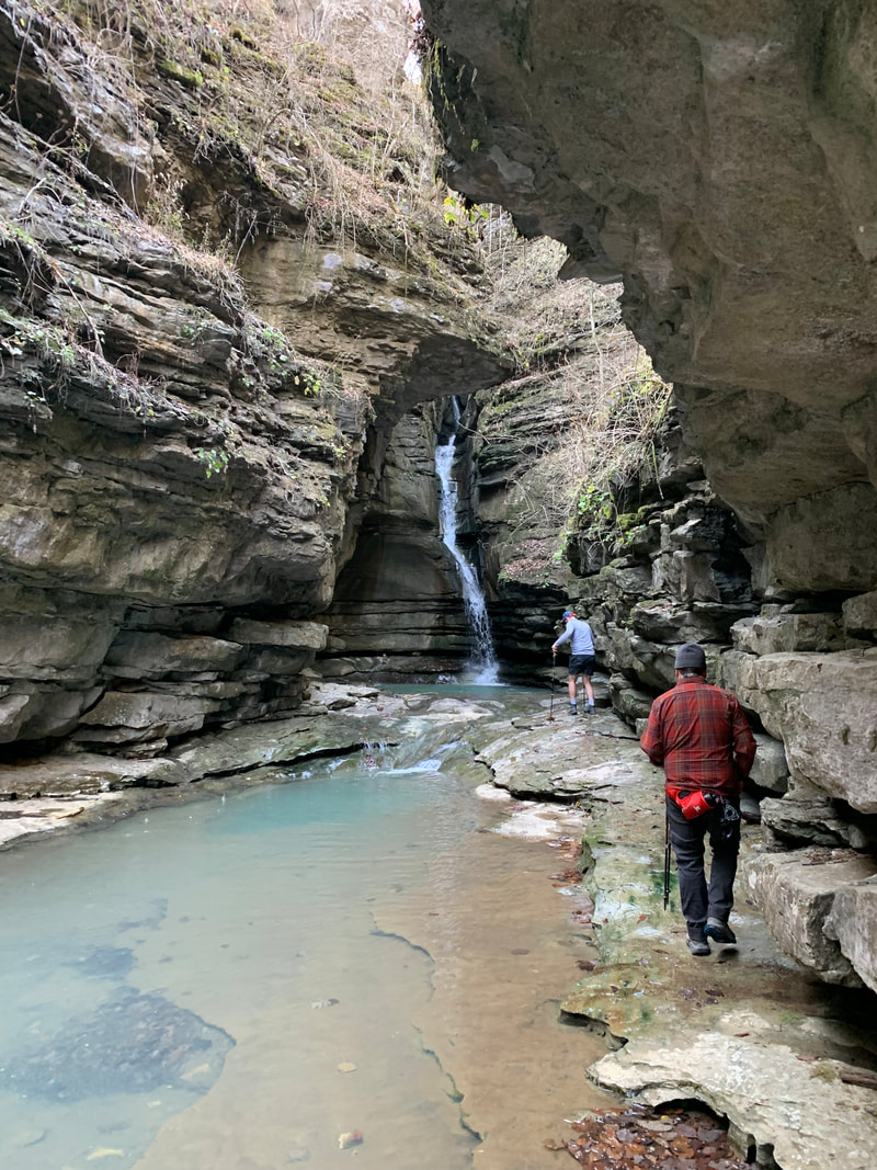
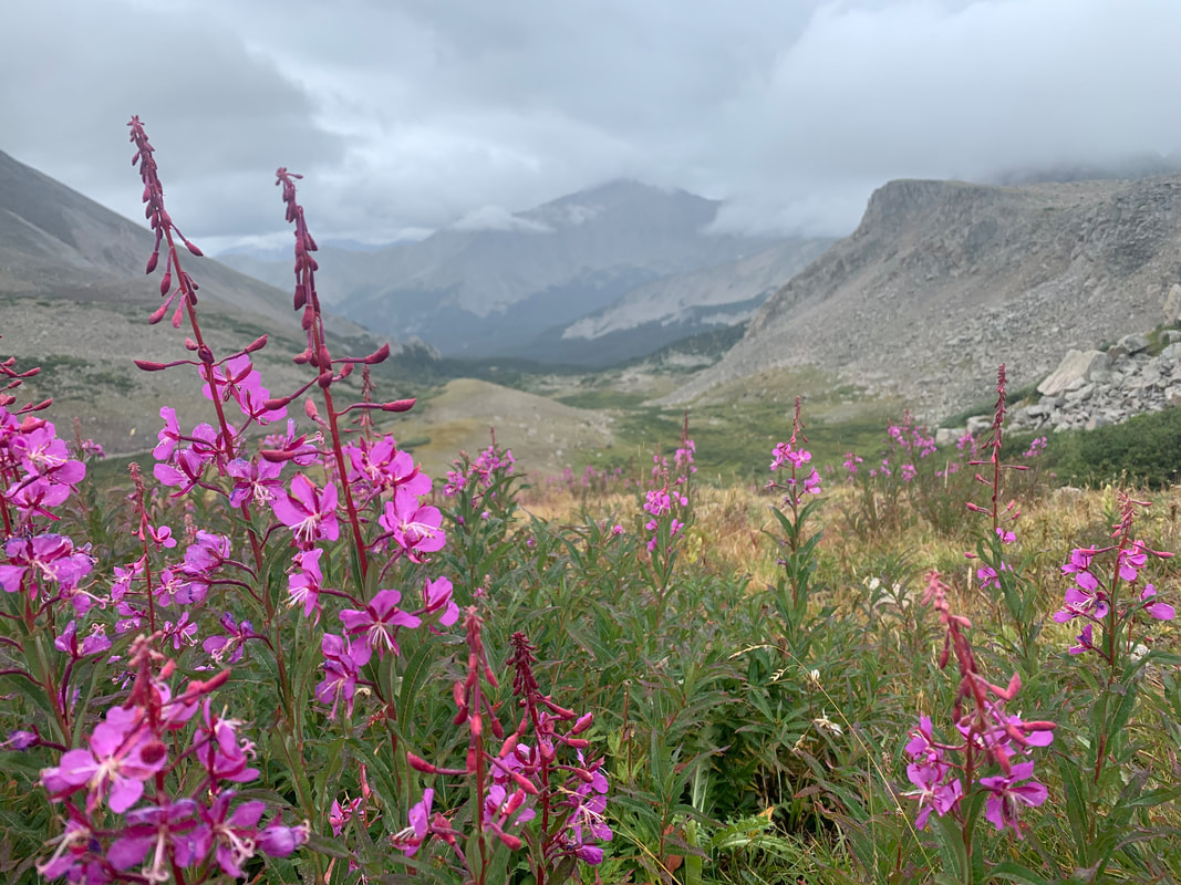
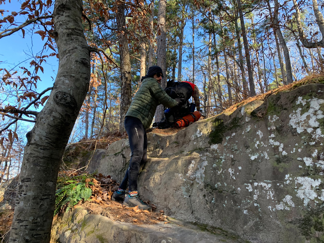
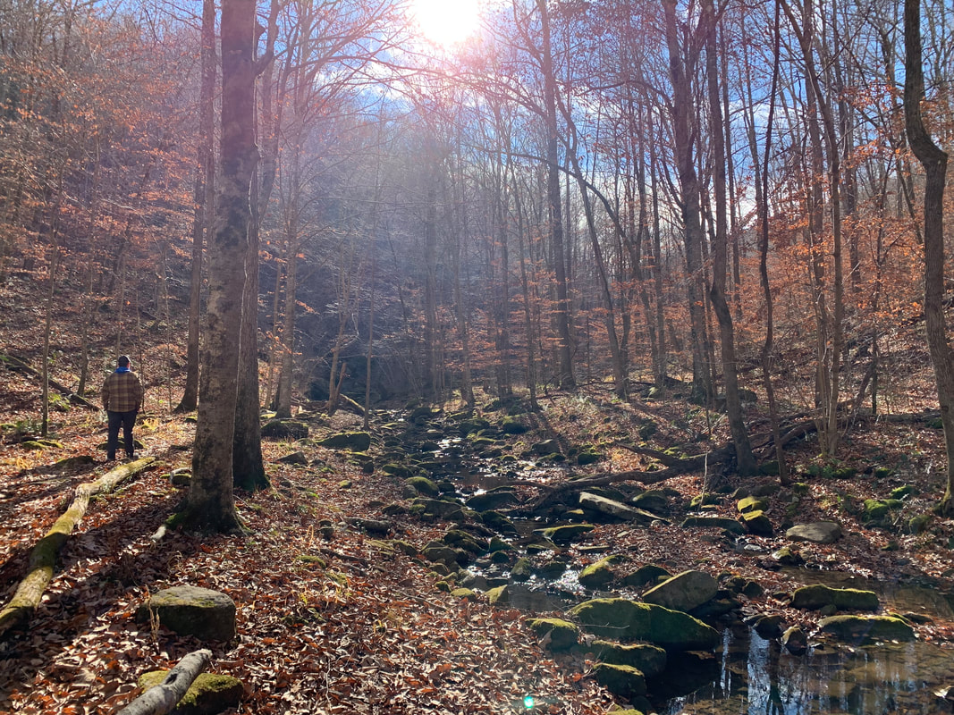
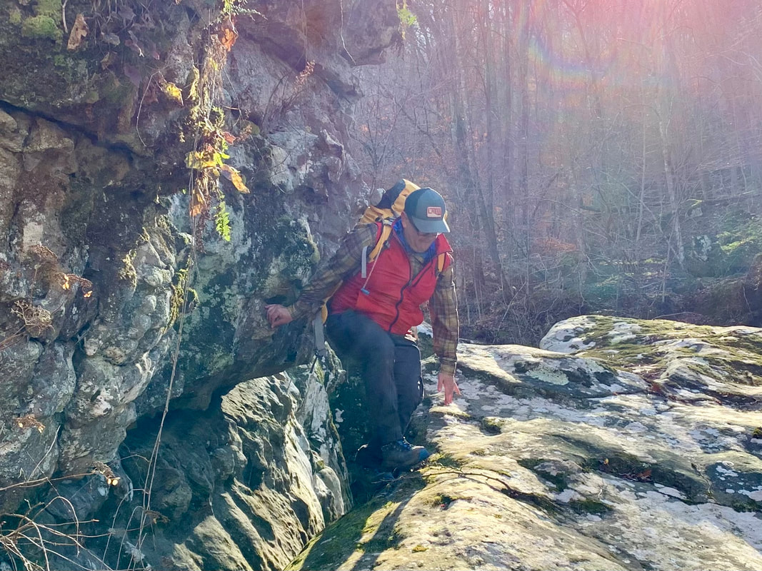
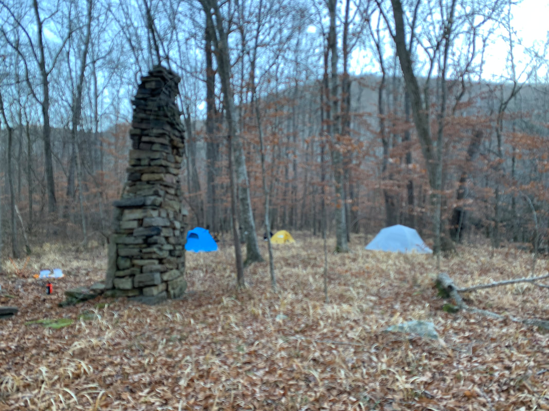
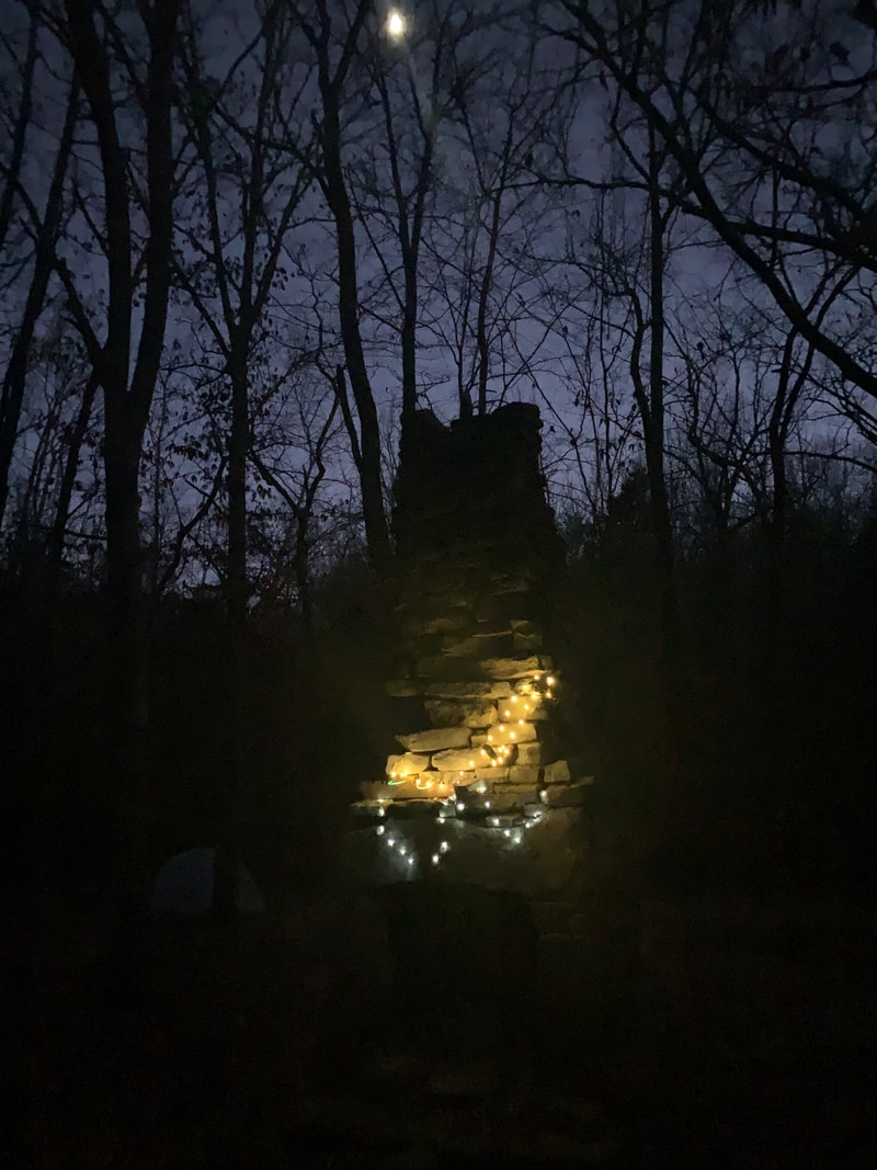
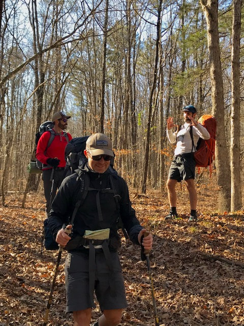
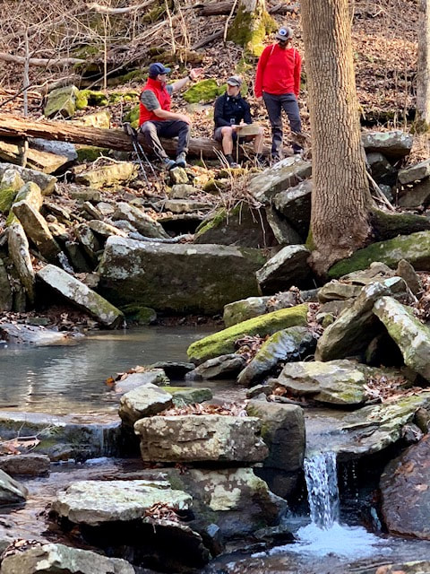
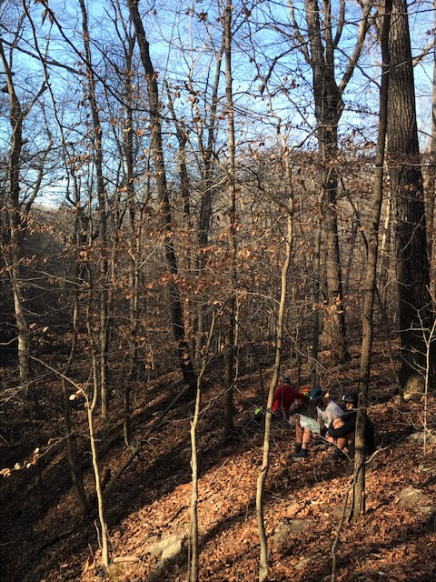
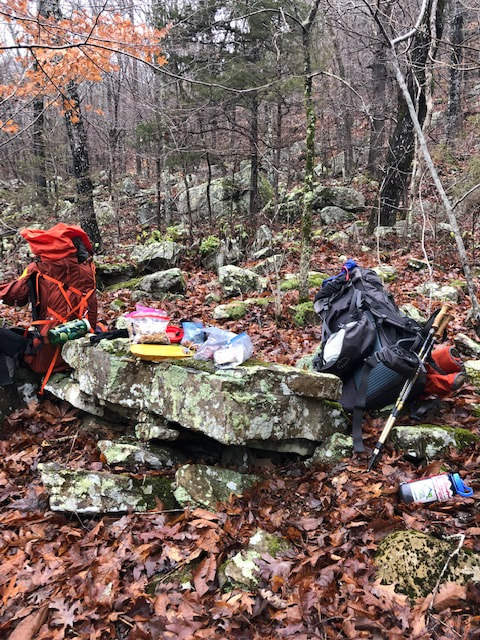
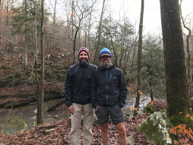
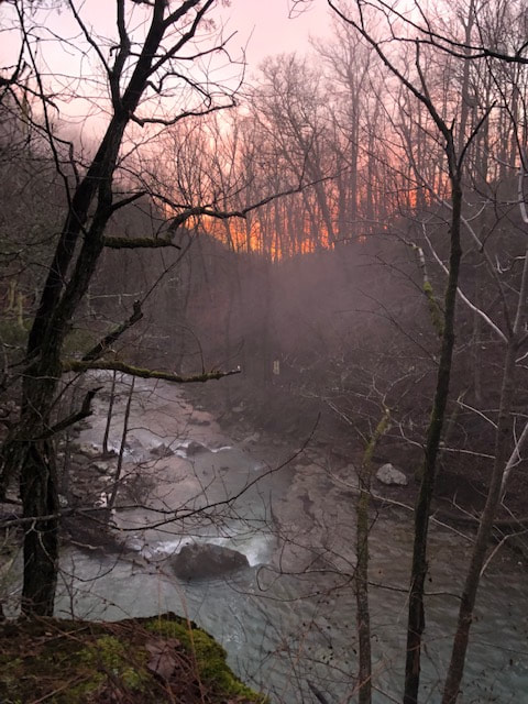
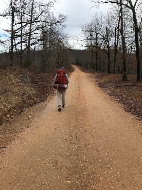
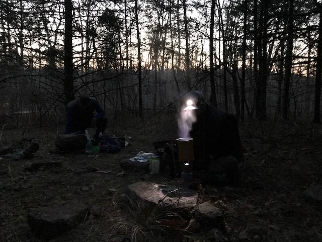
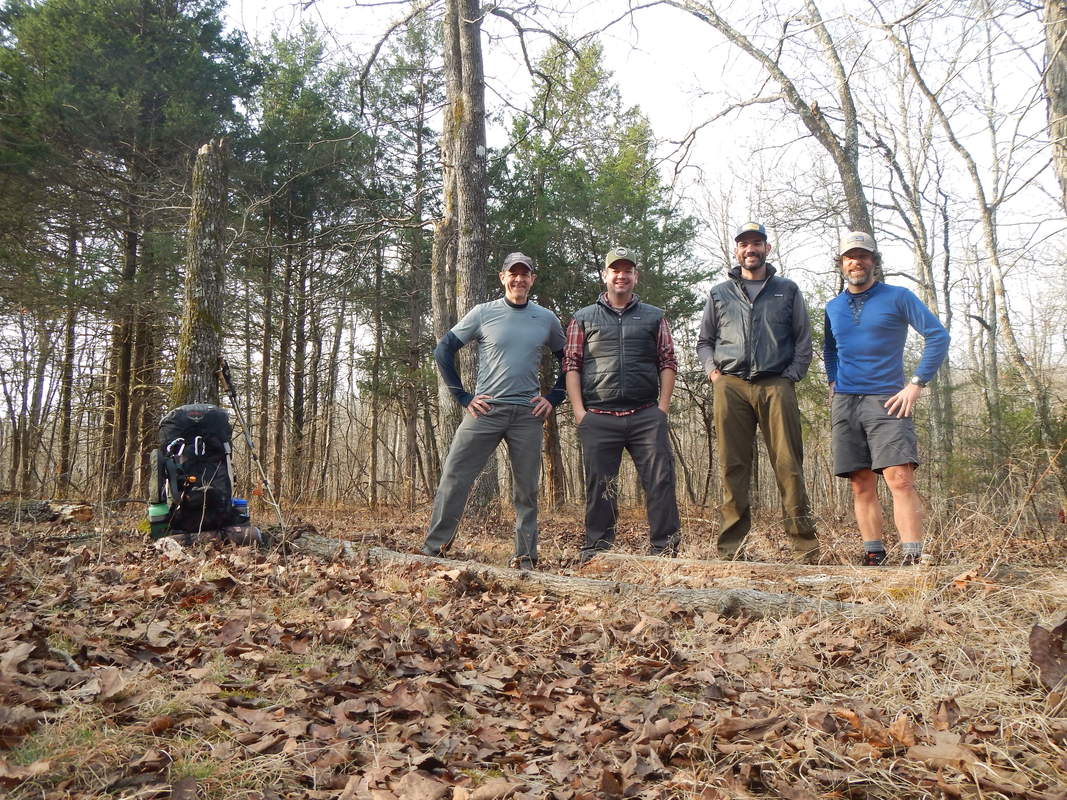
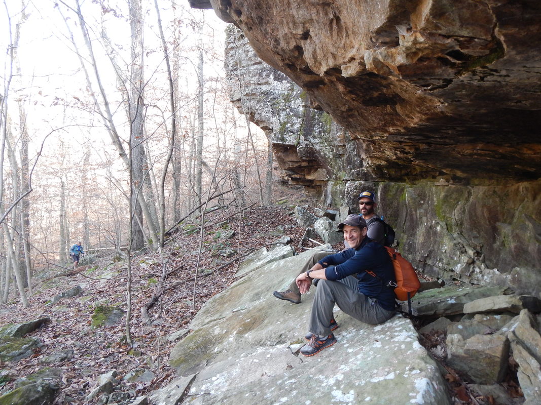
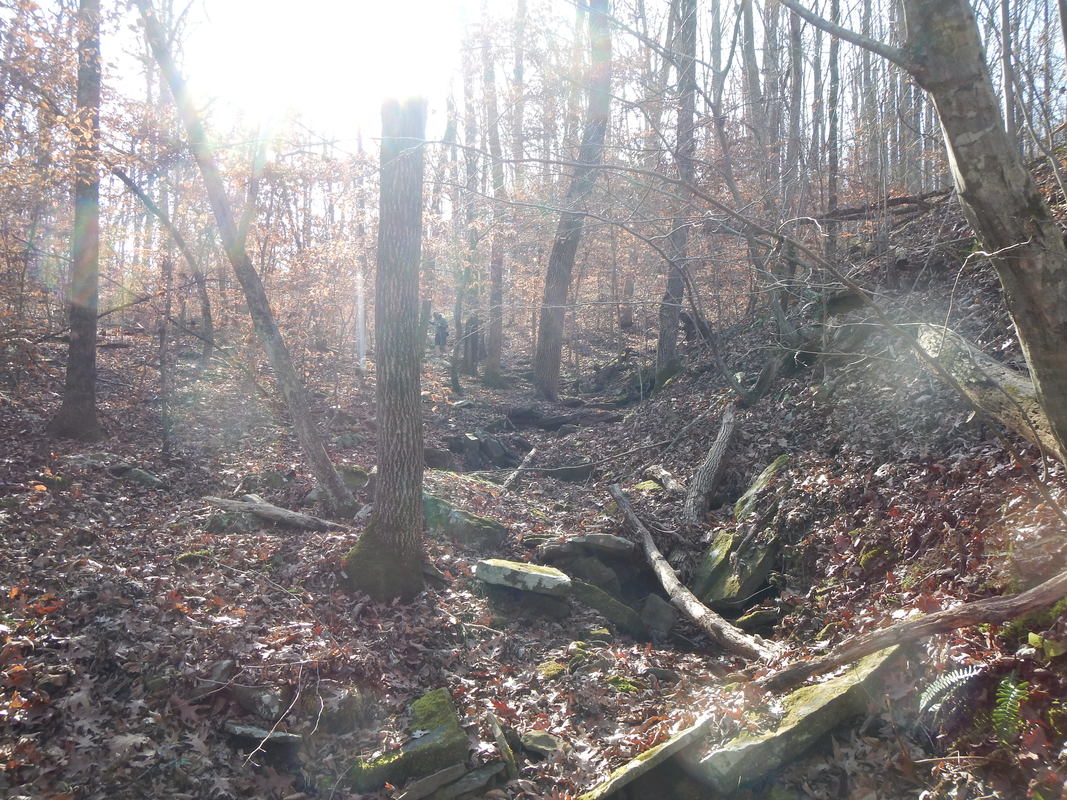
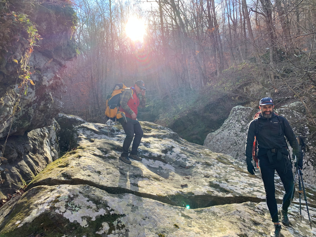 We camped at Magnolia Falls TH as lightening lit up the sky, Pine Treetops swayed making rocking chair noises throughout the night. We woke to a cold morning and continued cold through out the day with full blast of sunshine. Perfect!! We packed up and started off toward Magnolia Falls, the trail ended there and we where forced to follow the cliff edge to a place where we lowered our packs down an edge and followed by sliding through the fallen fall leaves on our butts. Eventually we made our way down to the Magnolia Falls drainage, following the creek to Boen Gulf drainage where the fun really began. We navigated huge boulders, taking packs off and lowering them down boulders then scrambling down the boulders ourselves, only to be challenged by lose rock continuously, dancing on this moving surface, then being walled in and crawling up the hillside to higher ground through the woods and eventually finding the Buffalo River. The Buffalo River was surprisingly lively. It was flowing with enough water that we couldn't follow the streambed. A quick look at the surrounding terrain identified the opposite side as the path of least resistance. We found a gametrail that lead us to Whitaker Creek. Then the search was on for the Old Homestead that was marked by a chimney and would be our campsite. Six hours from the start of the day we found the old homestead by following Whitaker Creek. The sun set and starlit skies greeted us with frigid temps that chased us to our tents after dinner. Awakening to a very cold morning, coffee was had as we watched the brilliance of the sun work its way down the cliffside to reach us! We packed our gear and worked our way up Whitaker Creek via and old trail, it quickly vanished but we stayed high on the bluff, seeking benches knowing we needed to stay to the right on lower fork. We eventually identified the confluence of Whitaker Creek and lower fork creek. We scrambled down from the bench we stood on to follow lower fork where our "out" would hopefully present itself while we made our way up the drainage. This "out" was suppose to be a notch wall that kept us from making our way out from the bench just above lower fork. Once again we did some scrambling. Following lower fork we had to make a move when a nonnegotiable boulder blocked our way and left us surrounded by wall to wall water. On hands and knees, grabbing rock and trees we worked our way out of lower fork to a bench. We followed the bench to a drainage that on the map looked like our way out. Heading up stream a 60 ft wall of rock encompassed us. Scanning the wall we saw where the land rose closer to teh edge of the wall. Upon inspection the 10 ft section had some "steps" that we could climb with packs off. We climbed and rested, looking at the map we identified what would be a jeep road to take us out. Walking through the woods we finally found the "road" that took us back to a gravel road. This took us to the Whitaker Point Trailhead where our car was parked. We celebrated in the warmth of sunshined with a beer. 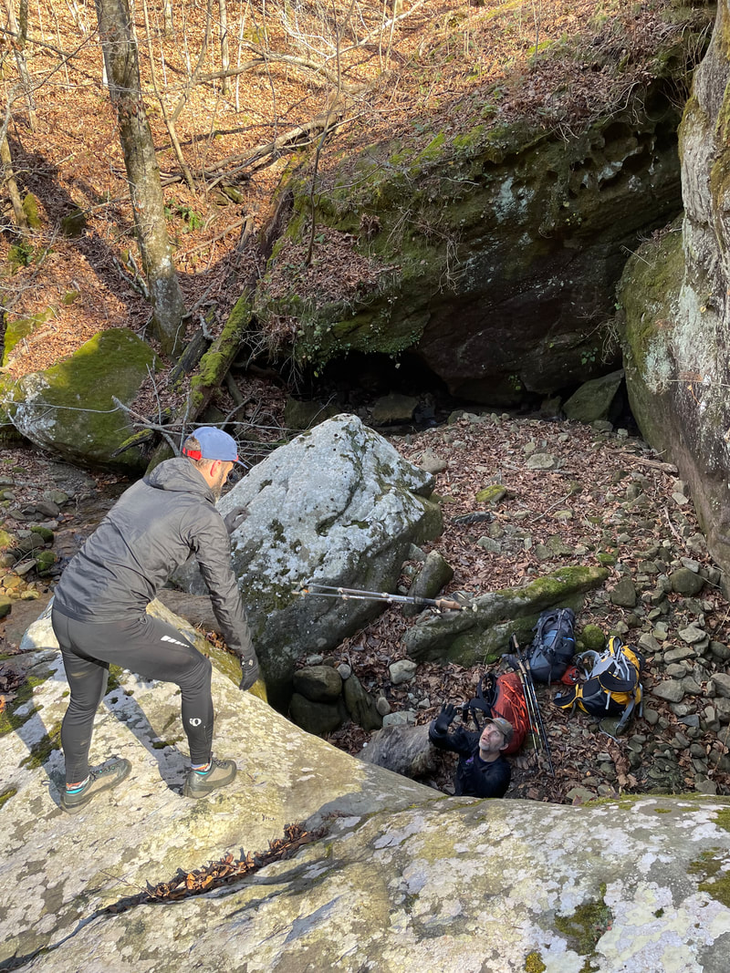
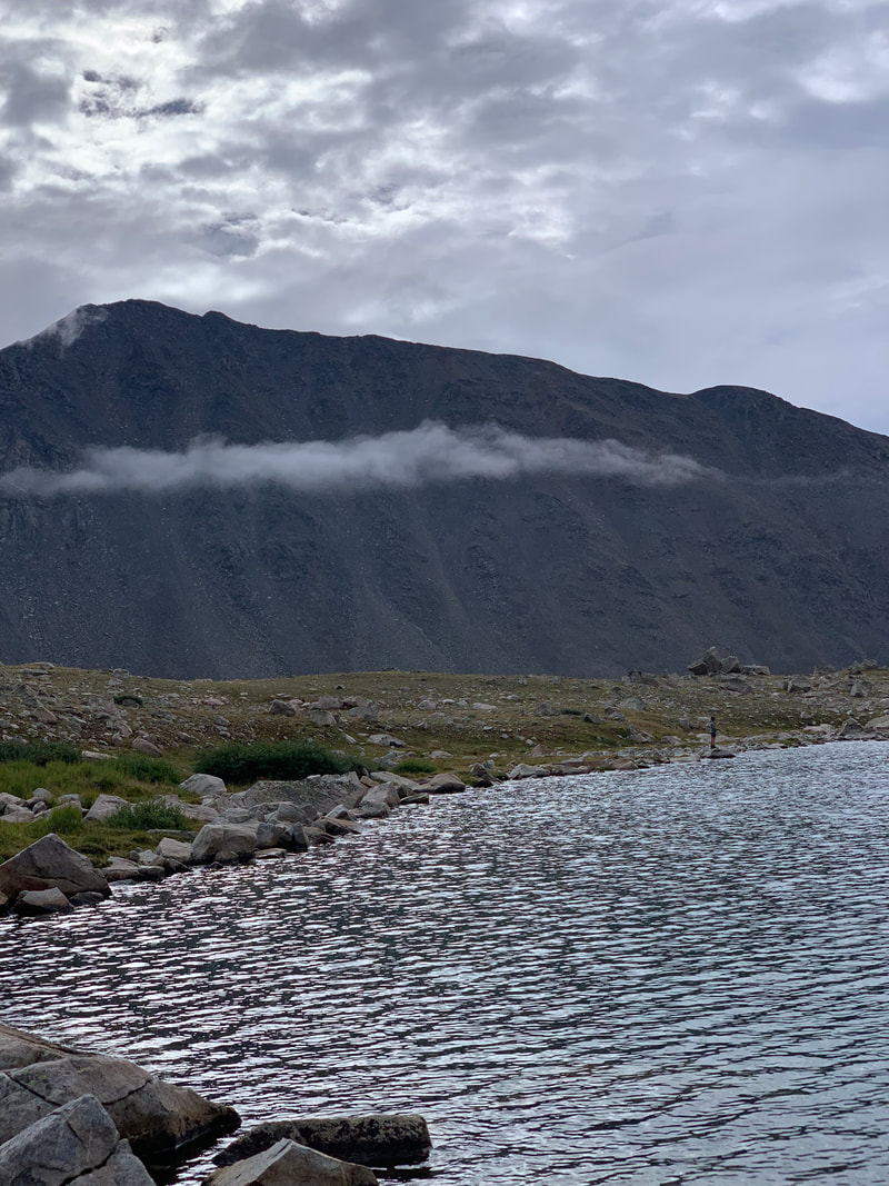
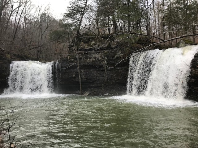
The campsite on Whitaker Creek below Whitaker point. 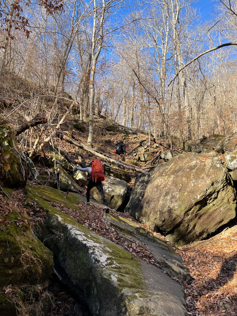 Lower Fork Branch
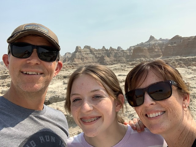
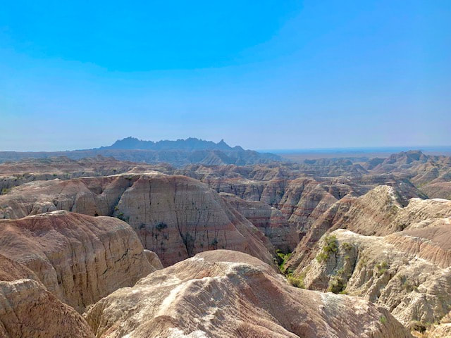
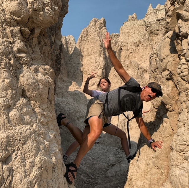
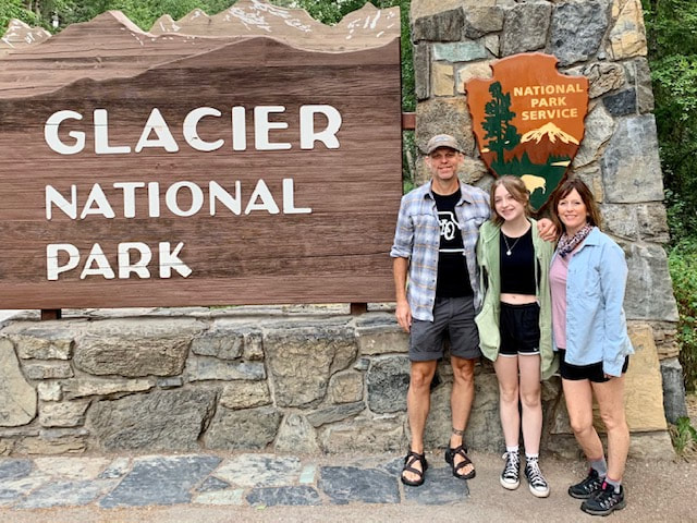
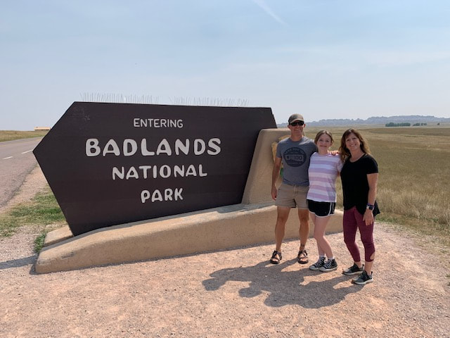 We arrived at Badlands National Park on our second day of travel. We took the tourist pic at the entrance with the sign in the background. As usual, we found a helpful soul to capture our image. Upon entering the park we were greeted by the striations of the hues in the incredibly exposed rock. In our excitement of the new views we stopped at the first trail and hopped out of the car at the door trail where the immensity of the landscape unfolded when we turned the corner to peak behind the nearby "mountains". We did a quick check in at our tiny but nice cabin and made our back out to the trails. We had fun on the Notch Trail, that included a fun latter climb and revealed and grand view. A great place to visit on our way to Montana! 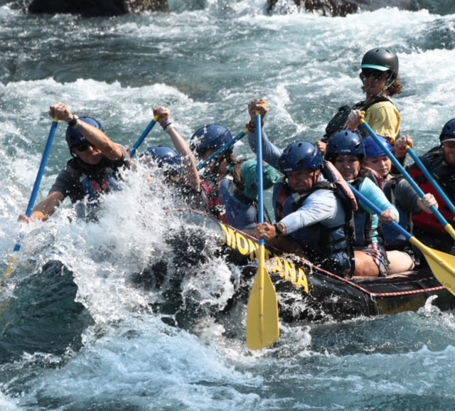 glacierguides.com Middle Fork of the Flathead River. Great Whitewater experience. 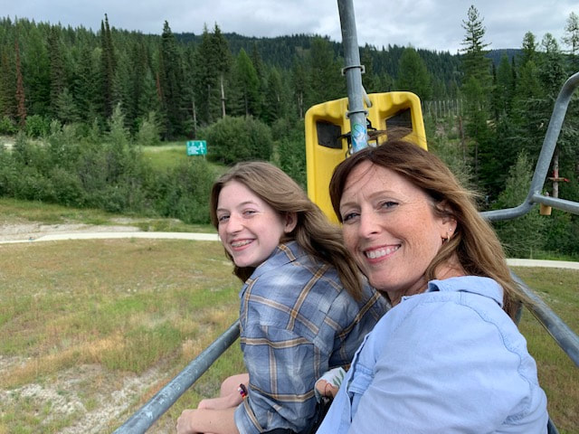
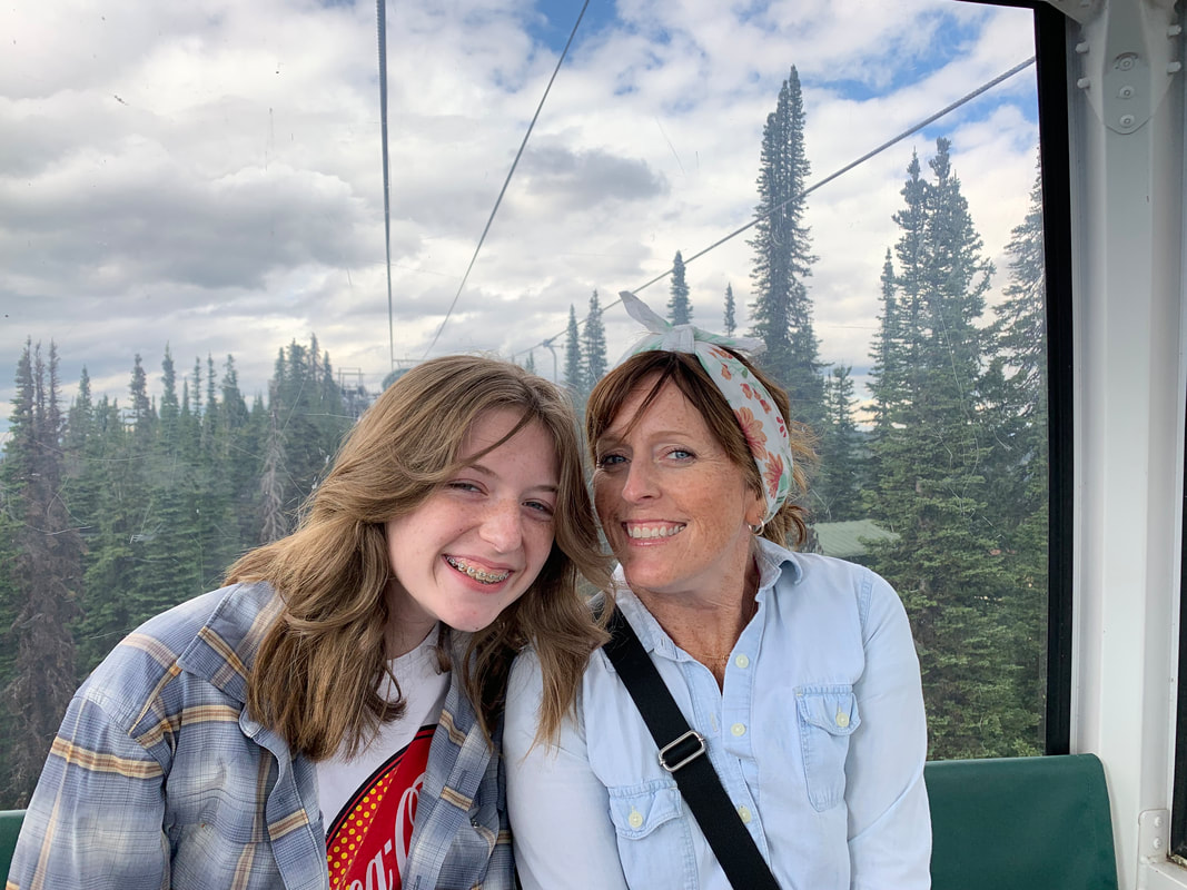 Fun at Big Mountain!
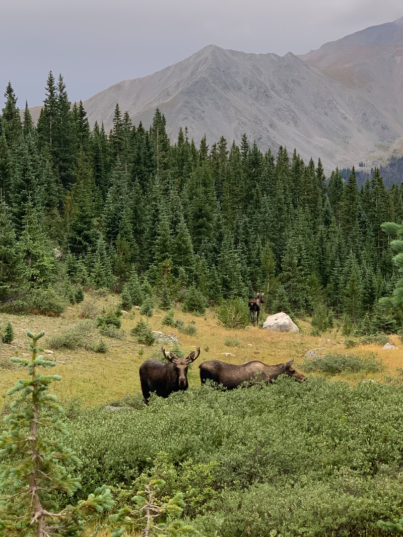
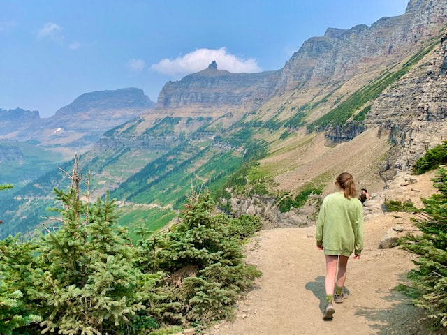
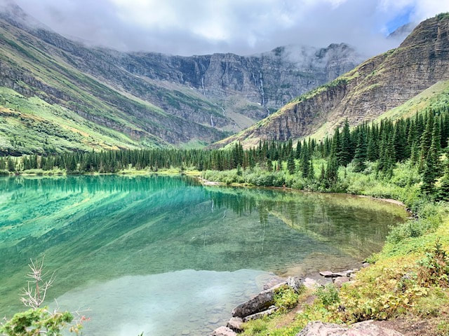
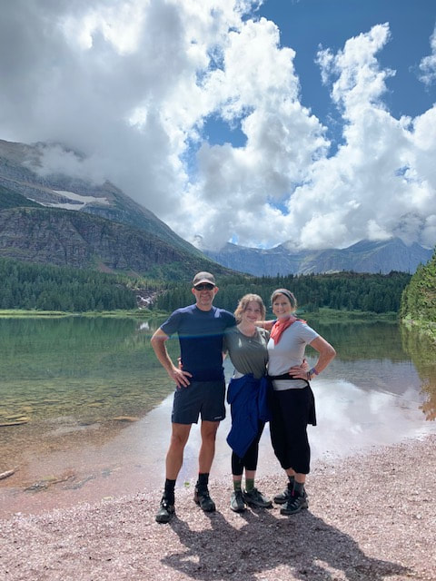 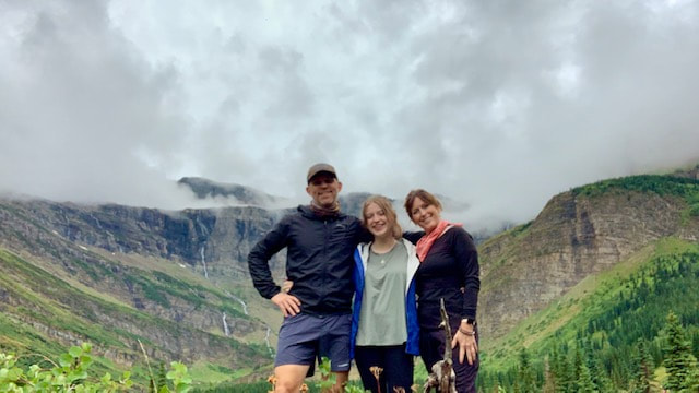 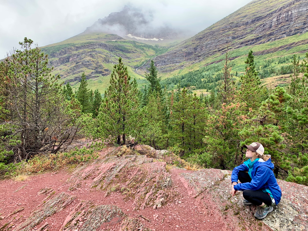 Many Glacier: The goal was to complete Iceberg Lake Trail in Many Glacier. We woke to heavy storms blowing through Whitefish, but who knows what the weather is like on the other side of the park. So we geared up and drove going to the sun road in heavy rain and clouds. Visibility was horrible as we ascended the road and as we topped out at Logan's Pass and clouds became incredibly dense. I glanced at the temperature gauge on the dashboard and it read 43 degrees, this should be interesting. We made it to the beginning of the Many Glacier area, and found out we had 11 miles of dirt/ gravel road to navigate. The rain continued to fall and the clouds were so low you wouldn't know mountains towered above. Although Iceberg Lake was the goal, clouds and lightening encouraged us to stay low so we decided to stay low and traverse the Swift Current Trail. The rain eased to a drizzle and we were excited because we heard moose like it in the area we were about to explore. We also noticed that we had the trail to ourselves, no one else was around. I chalked this up to the weather but it was super cool. We ran into two groups of people as we traveled to red rock falls. The lady said, " do you see the moose?" We stepped next to her and witness a female moose making her way towards us, following the shore but still in the water. The moose came within 20-30ft of us, Kelli had wanted to see a moose and Sophia had never seen one before! We continued forward, the rain finally eased and some clouds started to lift revealing mountains topping out high above. We took our time chilling when a couple told us a Bull Moose was around the corner off the trail. We traversed down the way and witnessed the huge Antlers and he lay in the grass chillin'.; We headed back, light of foot as the clouds continue to lift, the weather warmed and people filled the trail heading in as we headed out. 
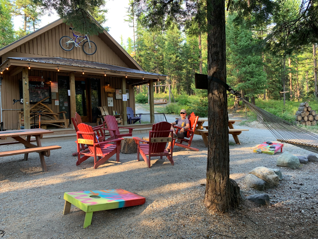
We spent two nights at the Whitefish Bike Retreat, making our base in their tiny cabin. It was a nice set up with a porch and a fire ring outside. The people were kind and welcoming with great knowledge of the surrounding trail opportunities. I woke after our first night in the tiny cabin, excited about riding some new trails. The plan was for me to ride and end up in Whitefish were I'd meet my wife and daughter for lunch. I checked in at the office where they had my KONA hardtail ready to roll. "Cricket" helped me out by orienting me to the map, and pointing out a single track option that would allow for exploration and get me to Whitefish, 15 miles one way. I also downloaded an app that pinpointed my location just in case, there are grizzly in the area. The ride was super nice, I ventured by a lake, road mostly single track until I popped out on a gravel road that lead to greenways trail and straight into Whitefish. It was great to refuel with my family and relax before heading back. This was a little climbier so I took the quick route of 9 miles back to the Whitefish Bike Retreat. The setting created an atmosphere were I met some new people and heard about there adventures. https://www.whitefishbikeretreat.com/ 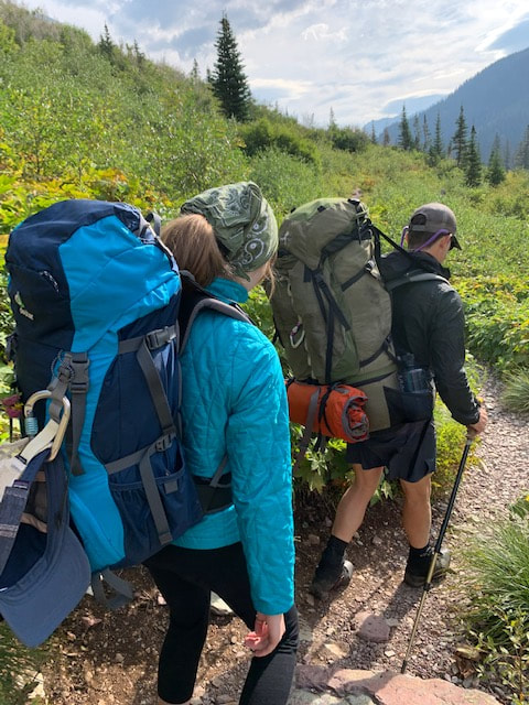 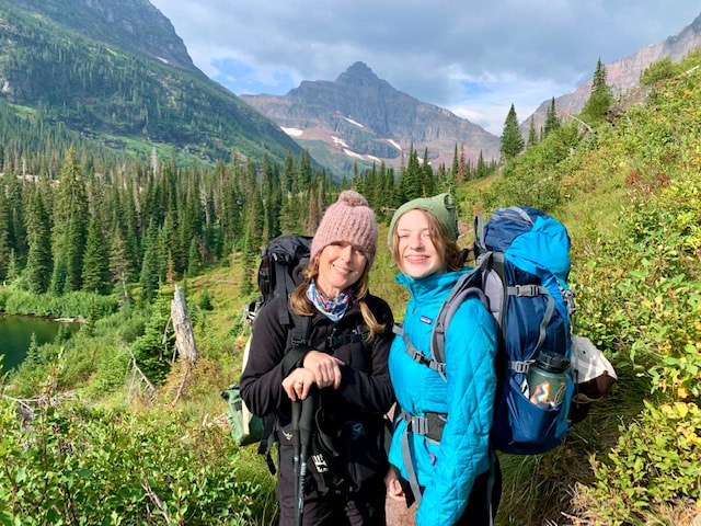 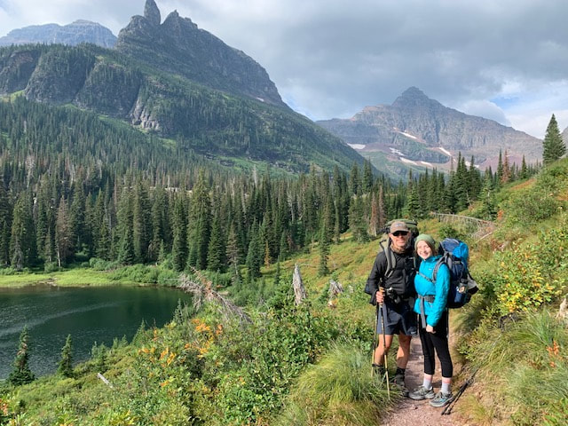 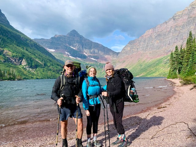 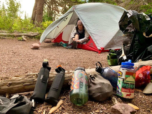 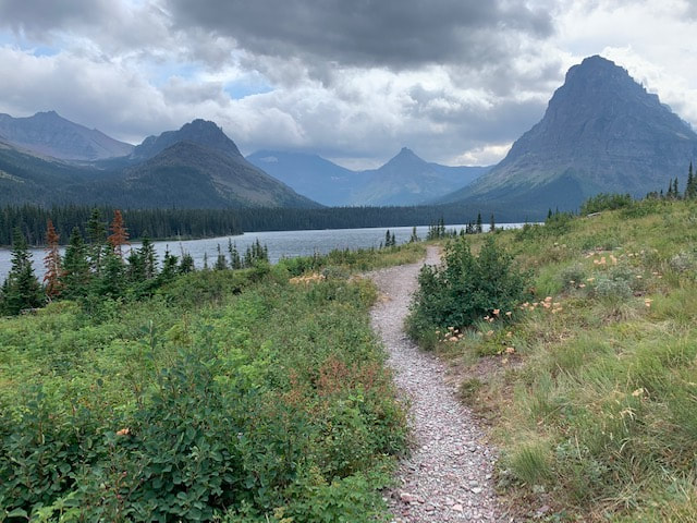 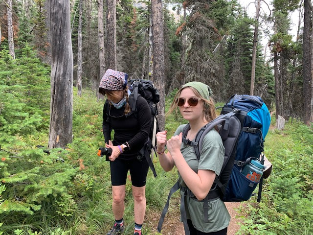 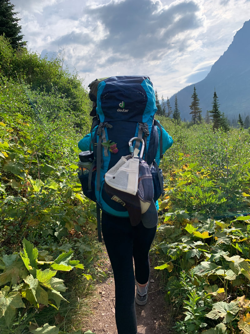 Backpacking in Two Medicine:
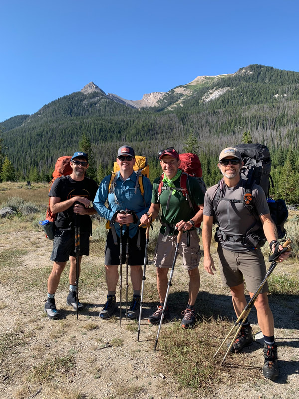
I arrived at the ranger station to get our backpacking permit for the Two Medicine area but I didn't have a hard copy. No problem, they said, but my name couldn't be found, "sorry"... no permit to be found. So we tried to get a walk-in car camping spot and the last one was gone too, What to do! I drove quite a few miles outside of the park to get cell reception and went through my emails and finally found it! Back to the Ranger Station, the original ranger came over to apologize. 1.5 hours after arriving we finally have a backcountry permit! After sitting through a terrifying ranger required bear video we hit the trail at 3:30pm! We started at the North Shore TH and hiked to Upper Two Medicine Lake. It was about 5 miles total. The first 2-3 miles was pretty easy sailing but Kelli had to grit her teeth a bit over the last 2 miles. BTW When I was at the ranger station actually getting the permit a call came over the ranger's walkie talkie from another ranger stating they needed assistance. One of the rangers at the station said it could be a bear and everyone except the ranger helping me went running out with bear spray drawn. Kelli and Sophia were in the car and saw everyone running out, they peaked around the corner to see the commotion, it was a false alarm. Back to the trail, I think we arrived at camp about 7pm. There was a bear box to store your food, a designated cook area for everyone and 4 camp sites spread out. We were the last to arrive so we took the remaining camp site. It was very nice, next to the water and closest to the cook site (maybe that's why no one else took it). Dinner was short and sweet. The wind was blowing so hard that Kelli had to create a windshield out of the thermarest chair to keep my stove lit. We made chicken noodle soup. I ate mine, and the leftovers from Sophia and Kelli, I was stuffed but we were in Grizzly Country. After dinner we walked the shore of Two Medicine Lake as the wind blew with fury. Sophia followed, filming the shenanigans as kids tend to do these days, inputting her snarky comments along the way. Soon after we retired to the tent to get a break from the wind. Not much sleep was had that night, the wind slammed our tent, would recede, then pick up again. I woke up first and took in the sunrise. The wind had stopped and the clouds moved on....for about 15 minutes. Then we were once again fighting the wind and watching clouds. They started to disperse into cotton balls as we hit the trail. We stopped off at the falls on the way back. We saw many visitors at the falls, since it was a short walk from the boat that delivers people from the main trailhead. Being near the boat ramp we could've waited 30 minutes to take a boat ride back to the TH but why do that when you have only so much time to be on the trail and enjoy the beauty? So I talked my wife and daughter into taking the South Trail around Two Medicine Lake. Well, There were some pretty good inclines along the way and my wife was feeling it, she continued to eat thimbleberries and shoot me a look every once in a while, especially when we saw the boat leaving the boat ramp we were at and taking a smiling crew of visitors to the TH that was our goal. We completed our hike and I retrieved the car. We heard some excitement coming from the parking lot. Some people pointed to the hillside saying there was a bear. One individual had a nice telescope set up on a tripod. He said to take a look and we saw a grizzly from a safe point. We returned to Whitefish and had a nice meal in our smelly backpacking clothes, We seemed to end up at Mckensey's Restaurant a lot. My wife surprised me with a trip to the Wind River Range for my 50th Birthday. I had been talking about the Winds for quite a while. My wife reached out to my buddies and asked if they would be able to join me on a trip out west before offering up this opportunity.
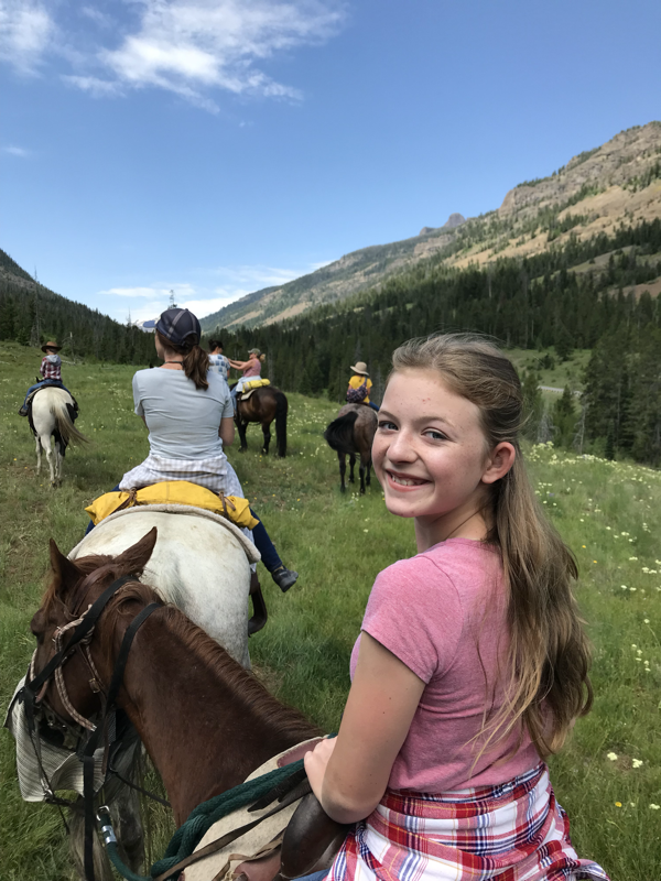
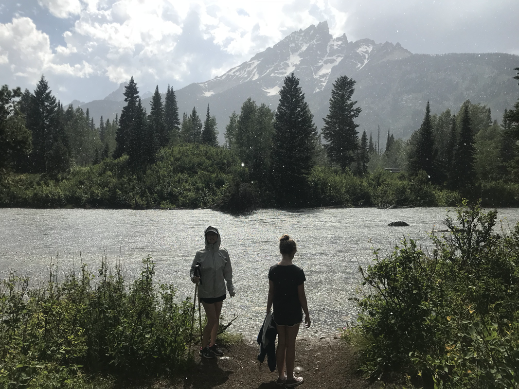
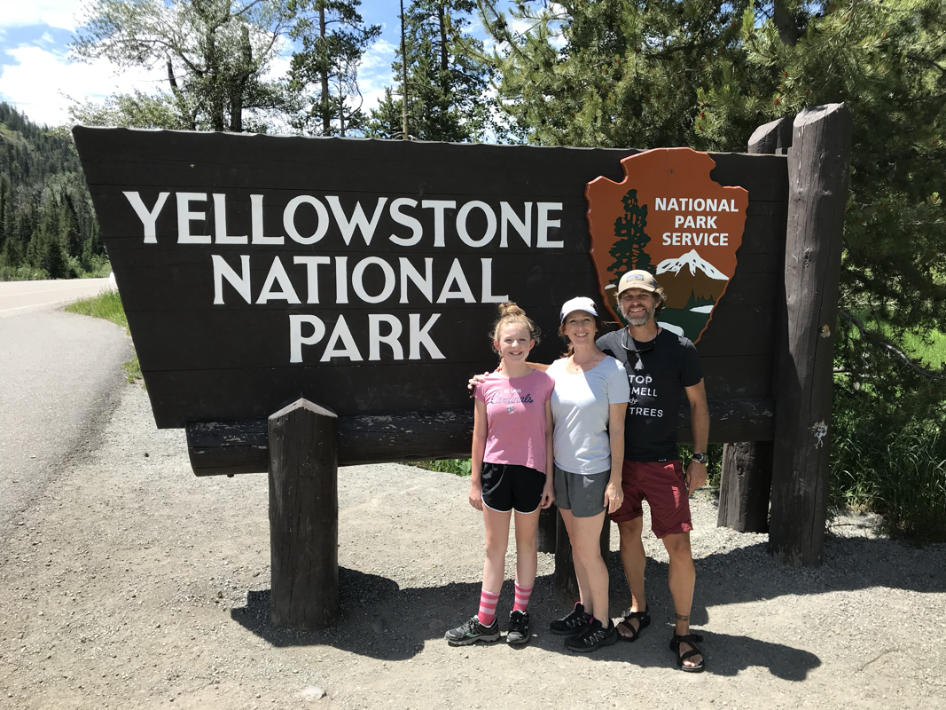
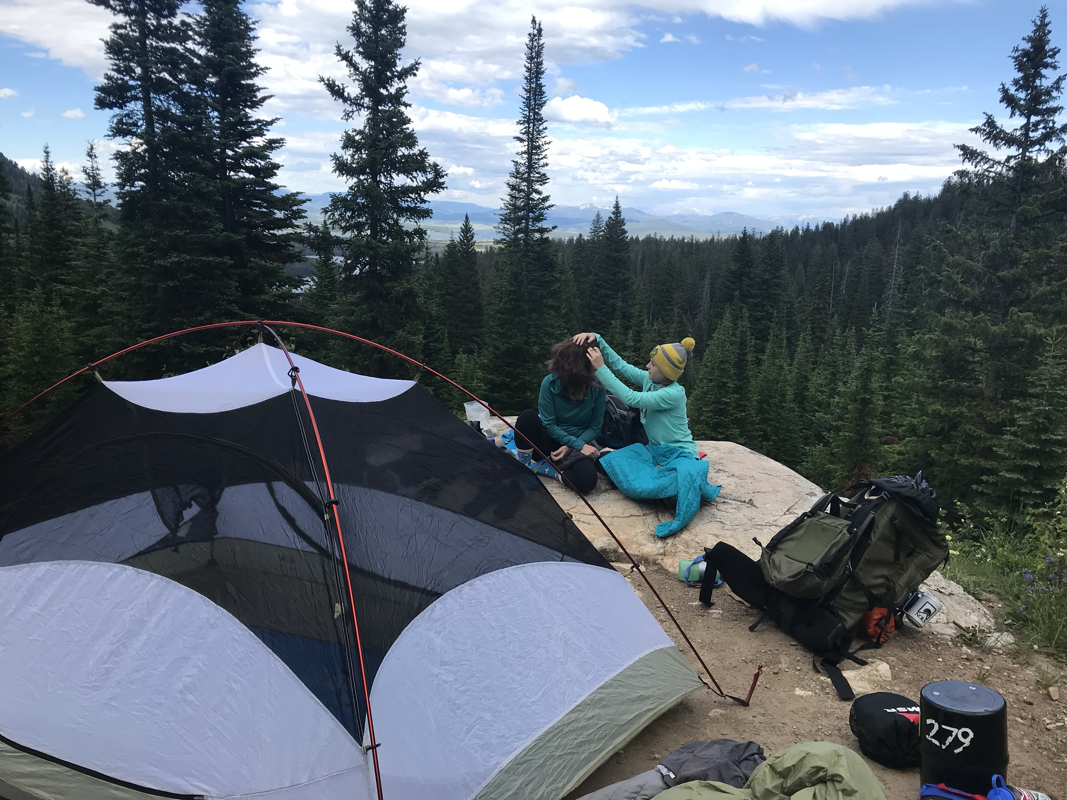
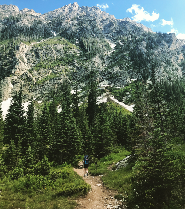
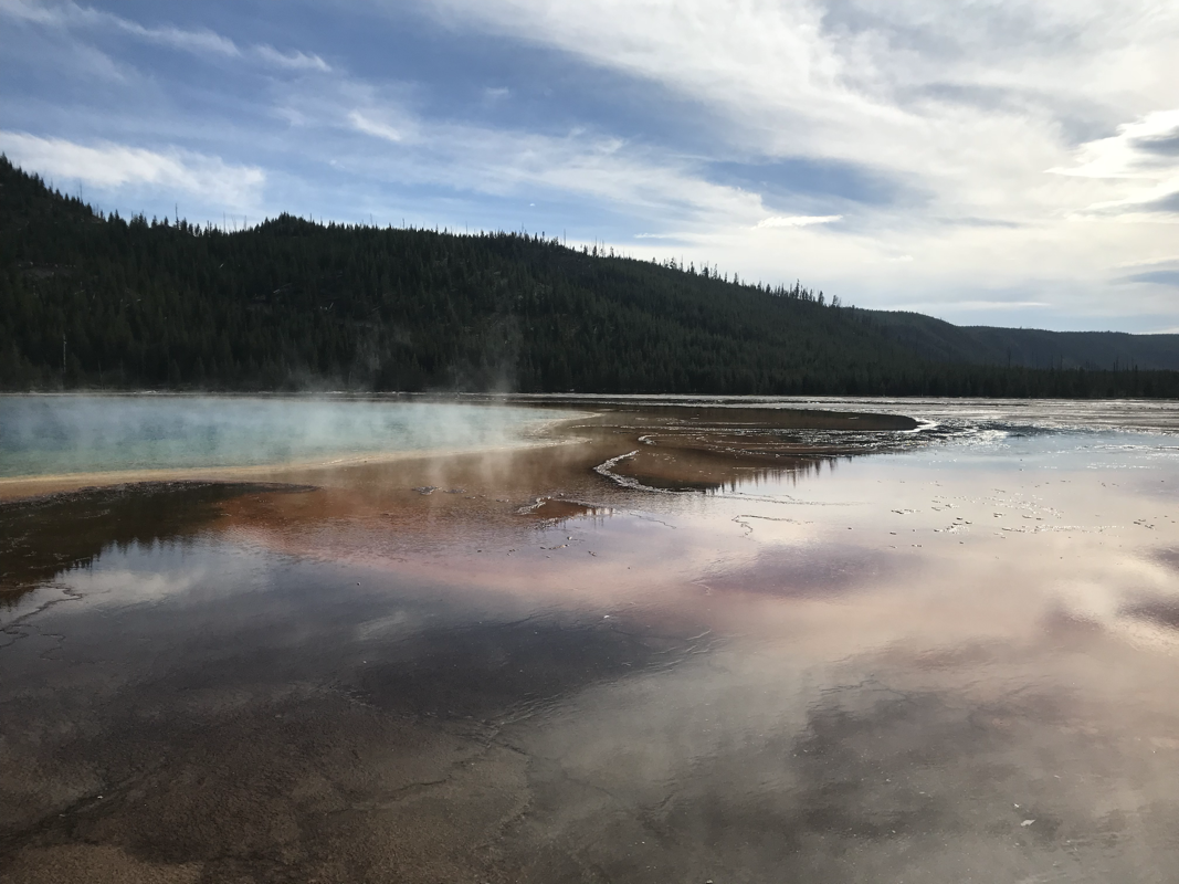
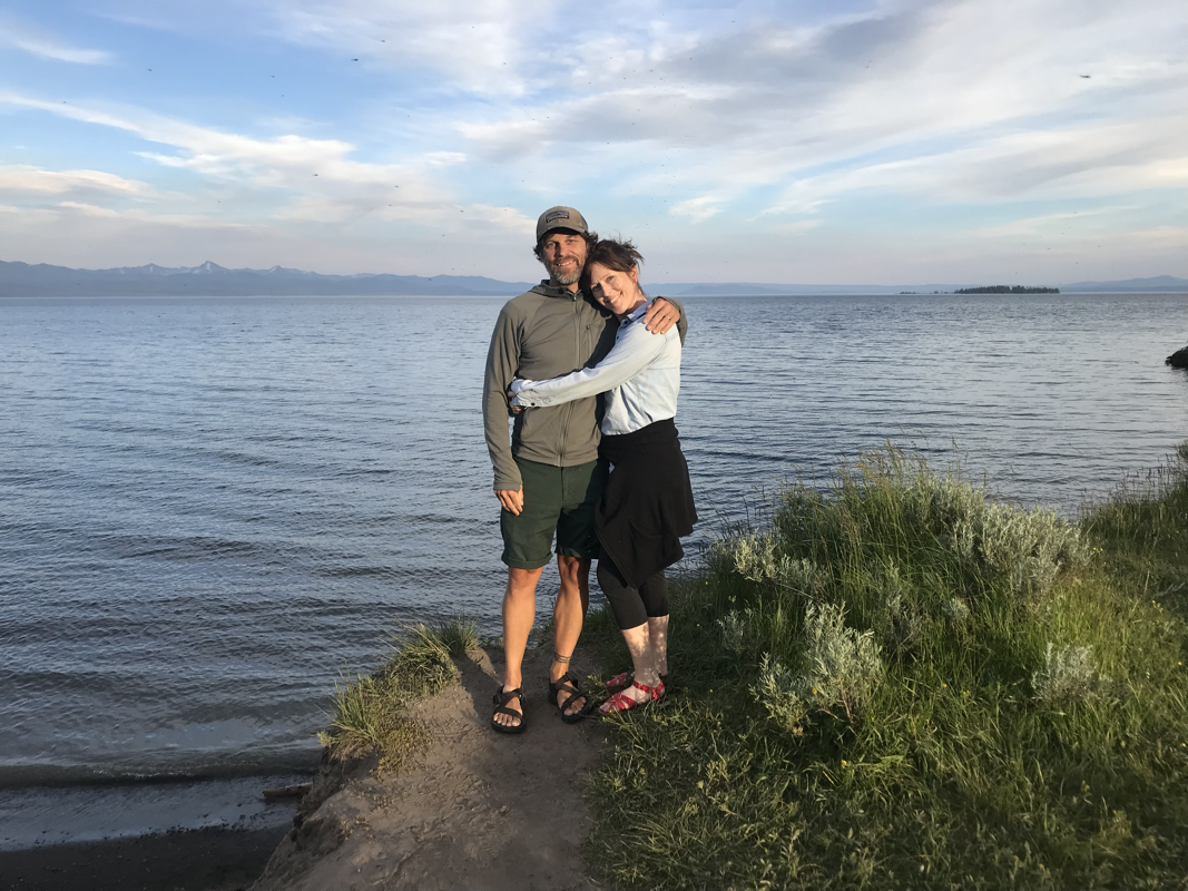
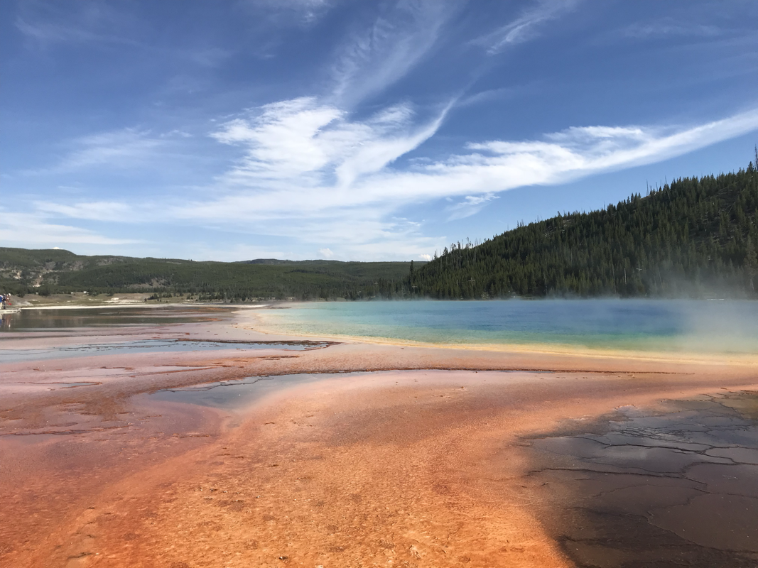
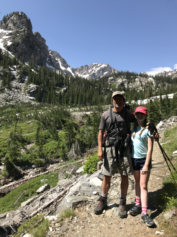
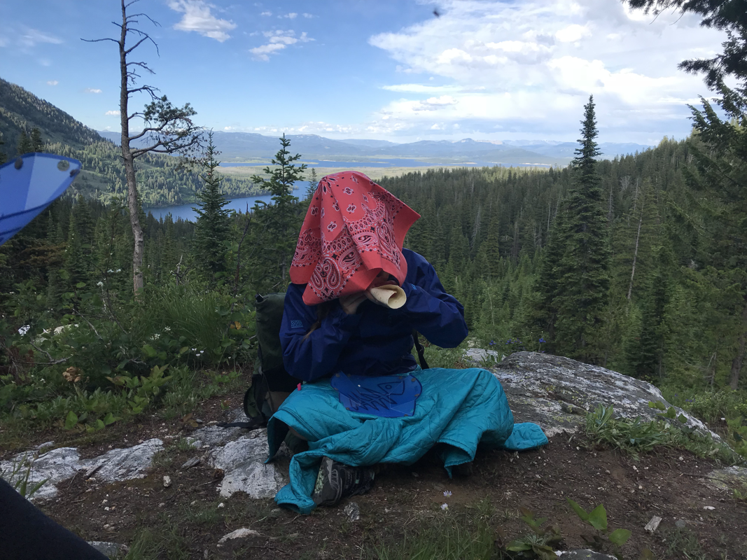
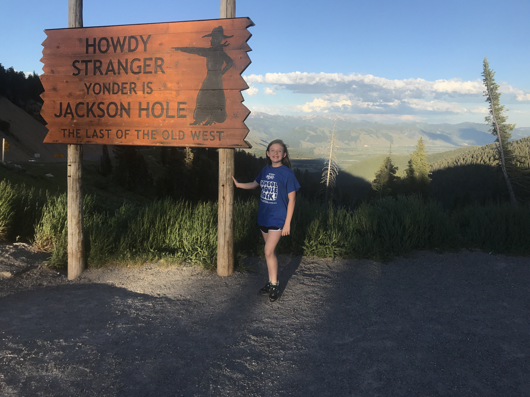
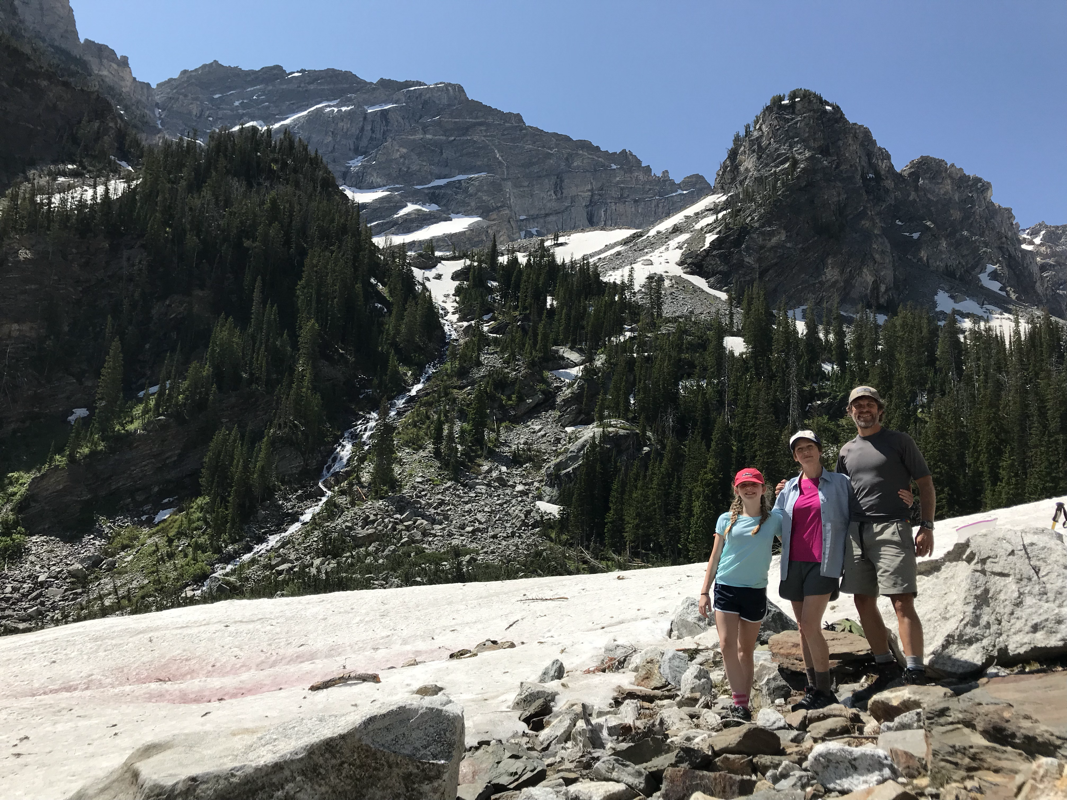
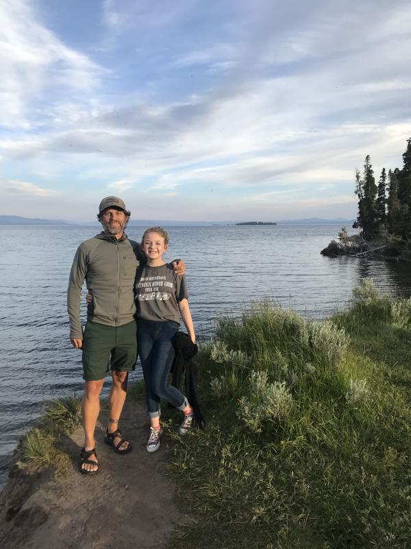
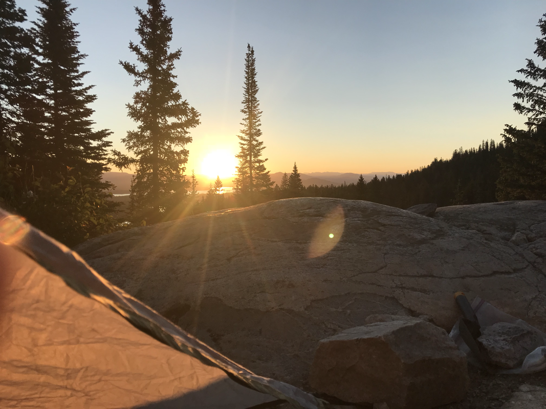
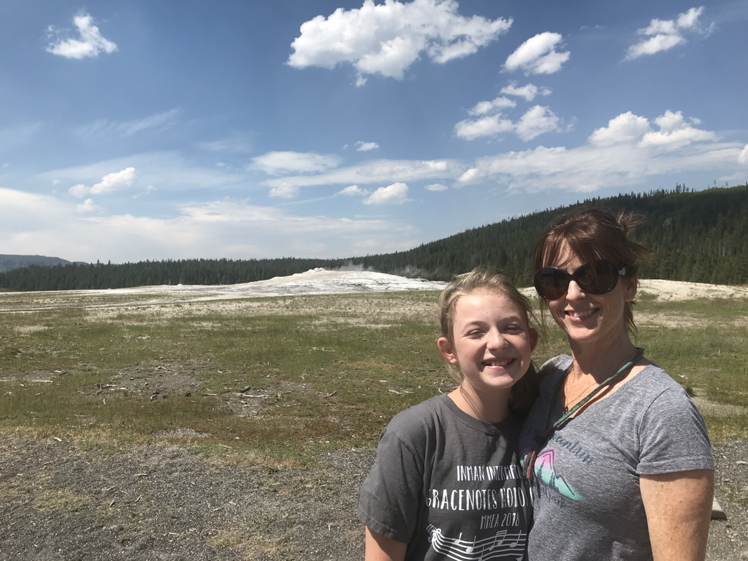
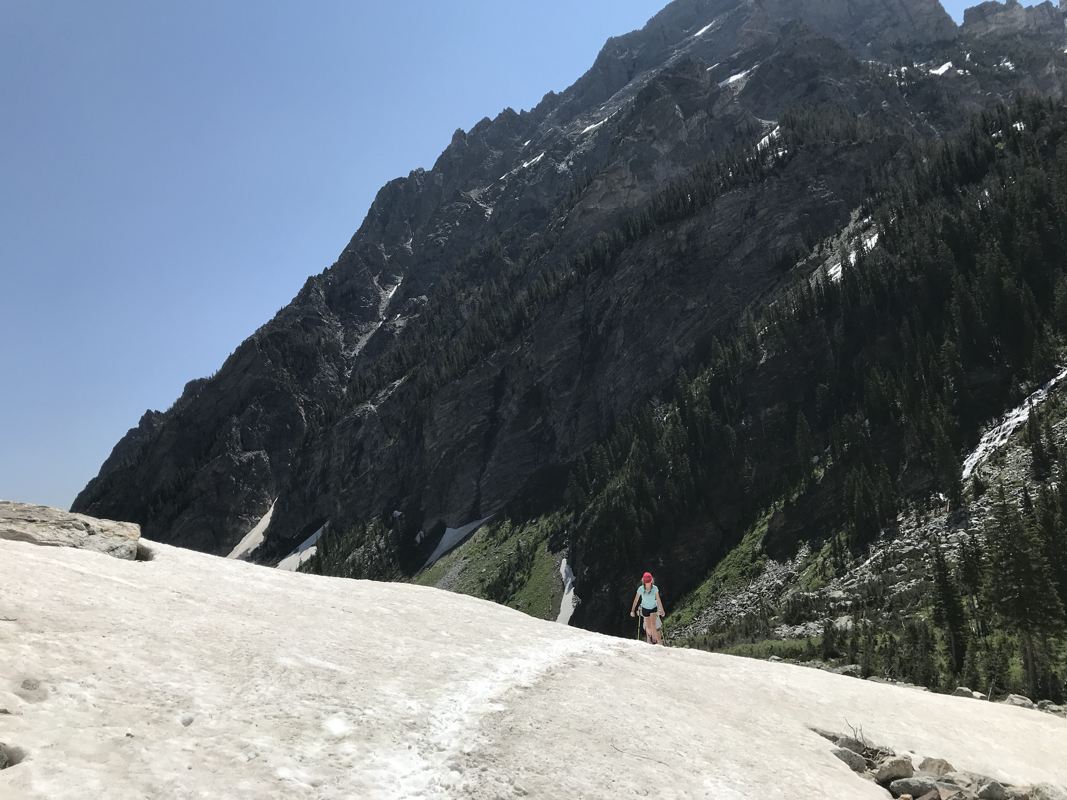
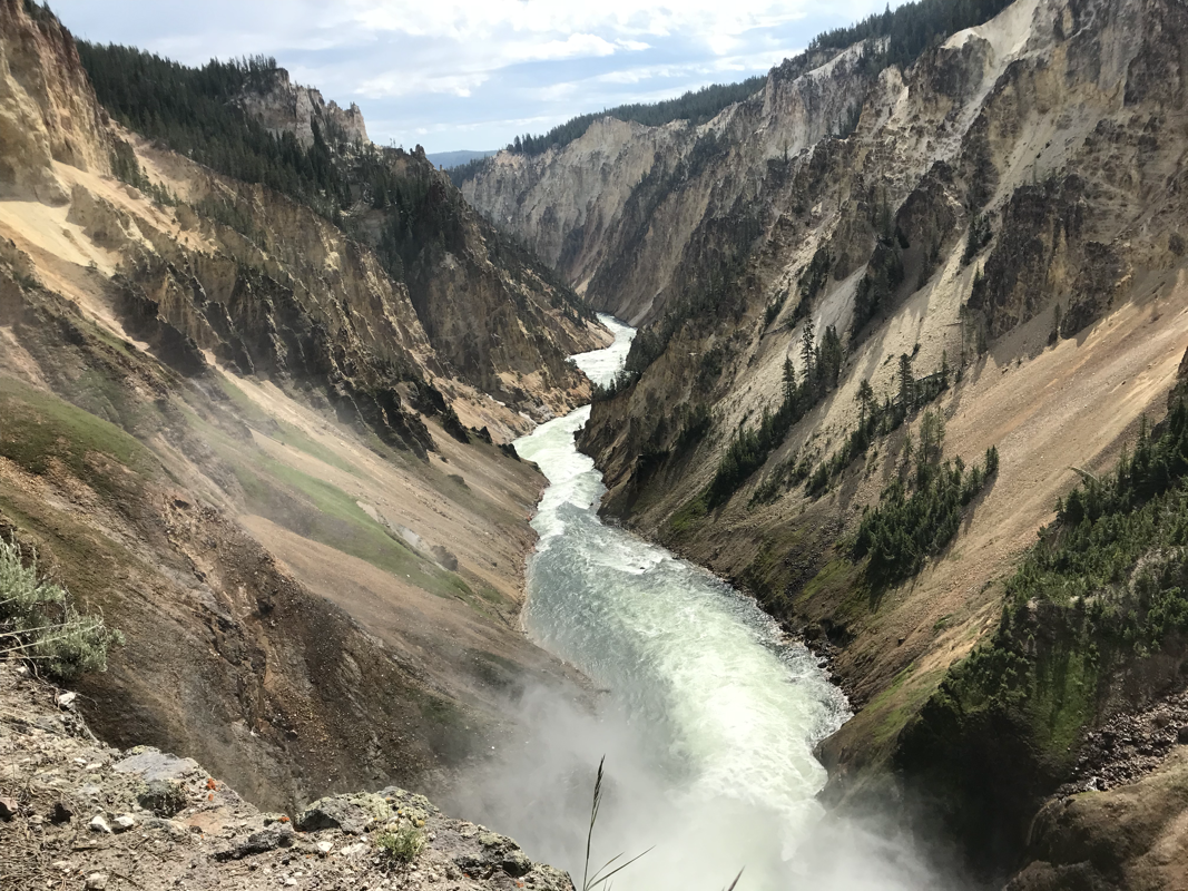
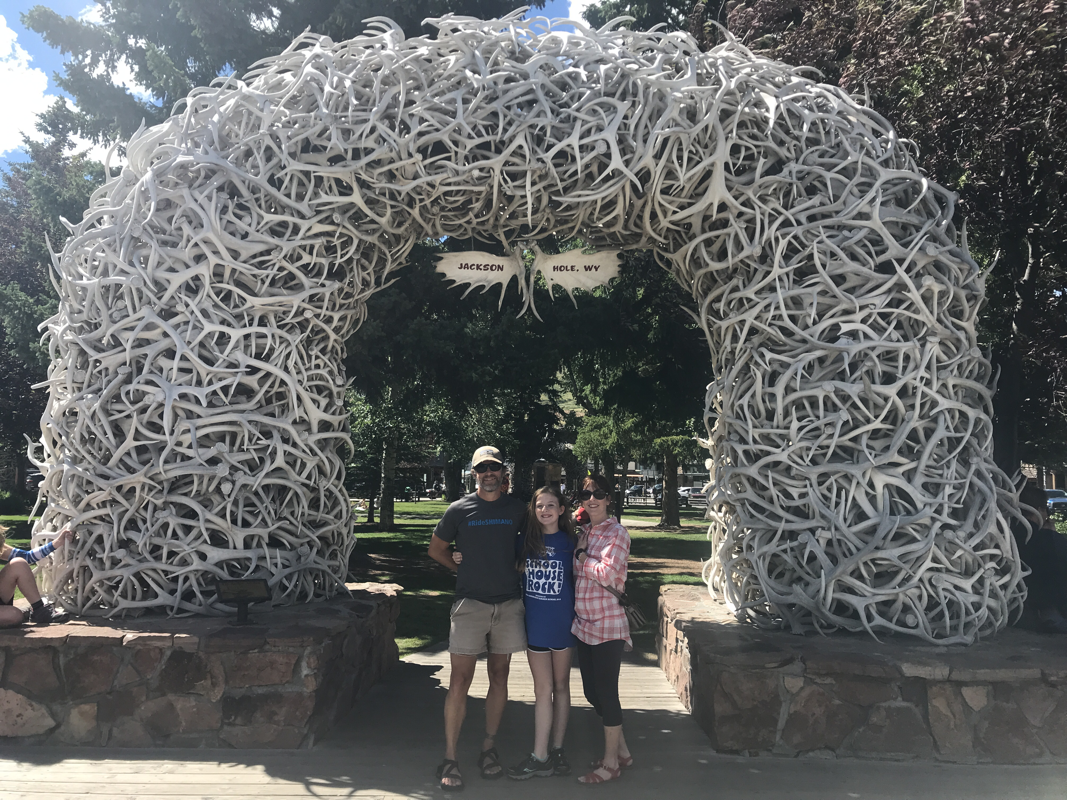
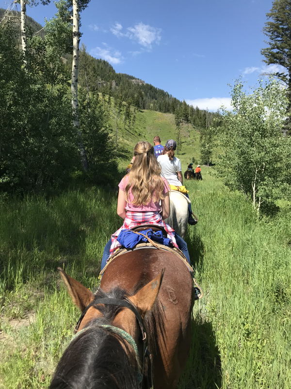
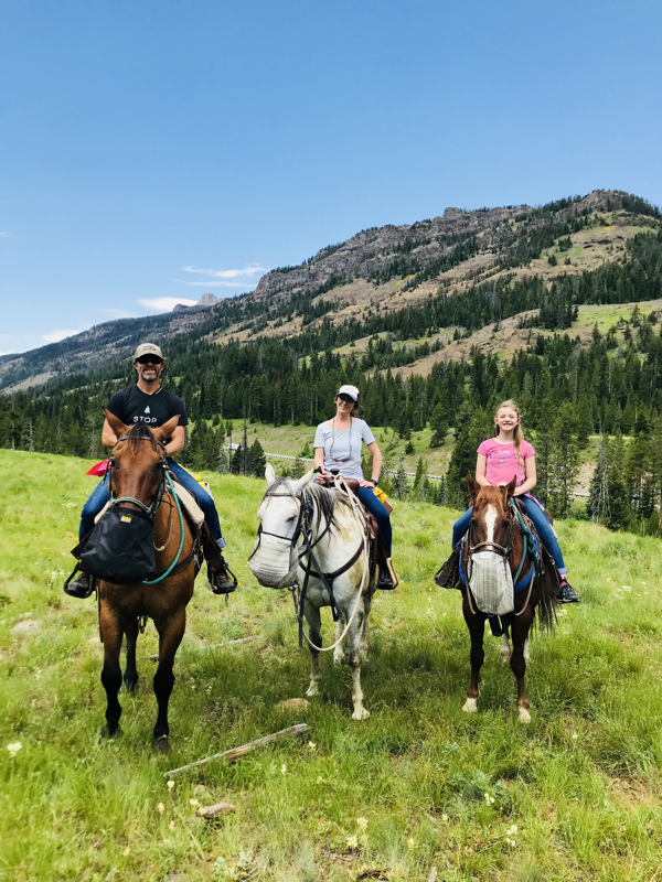
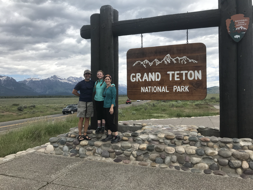
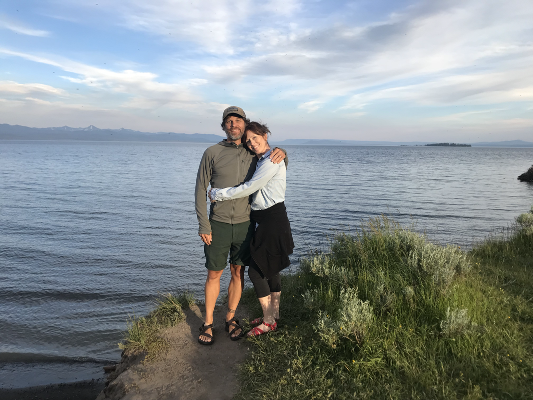
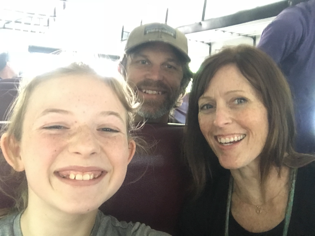
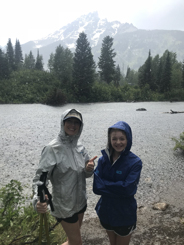
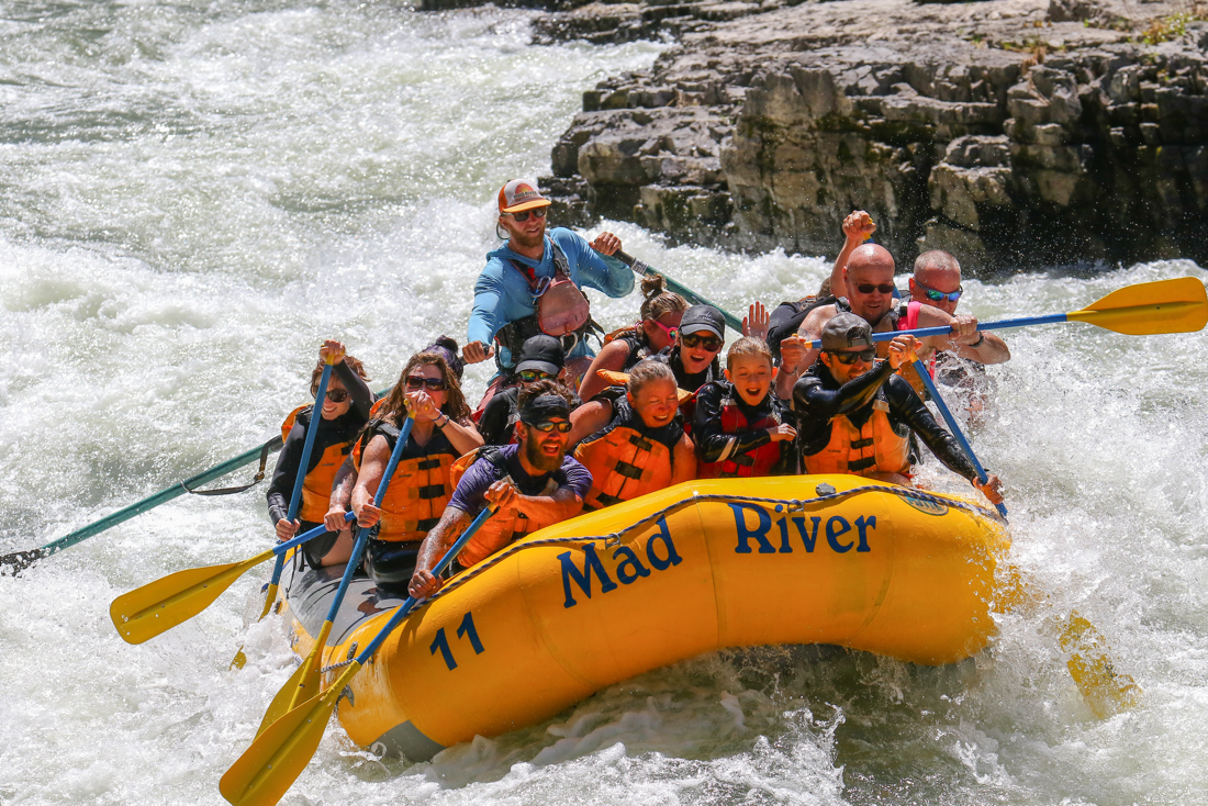
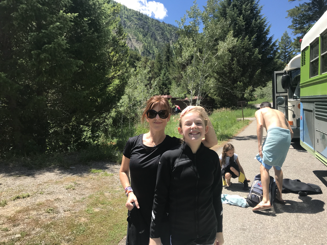
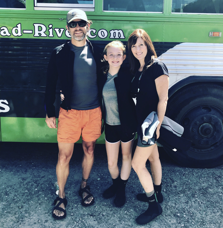
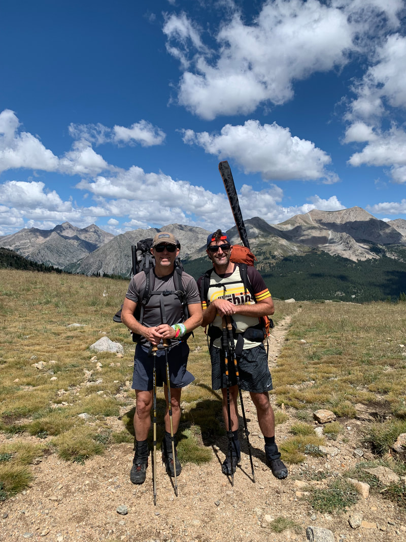
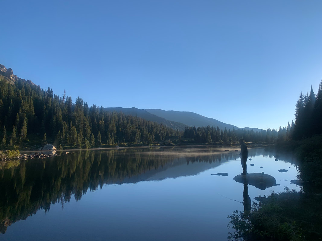
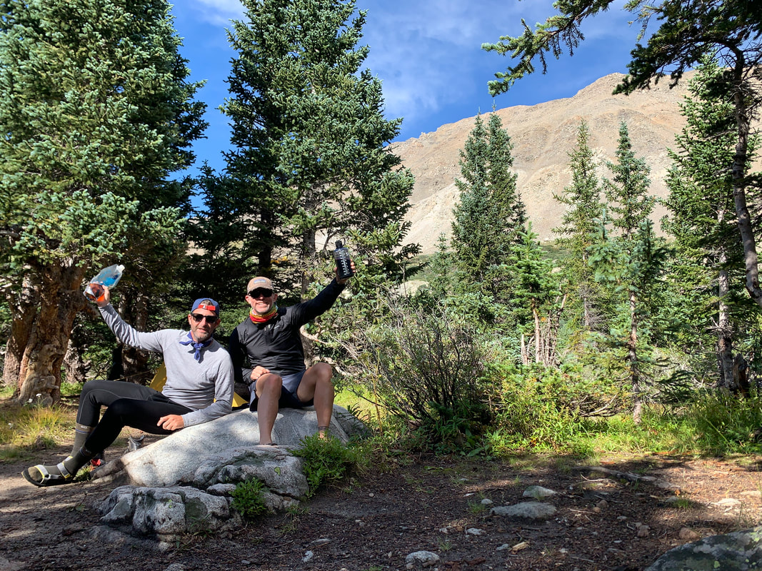
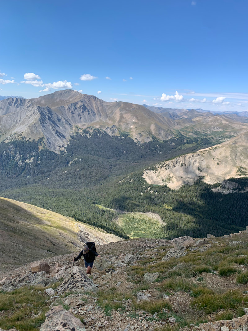
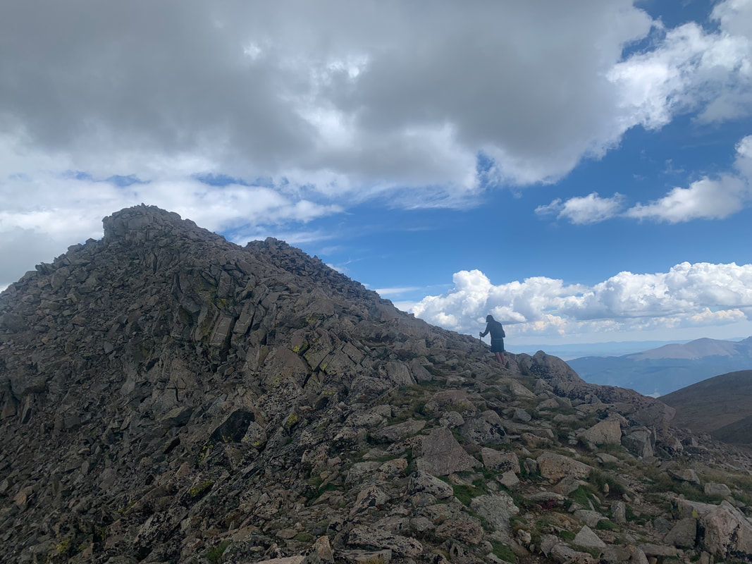
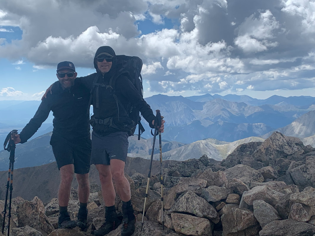
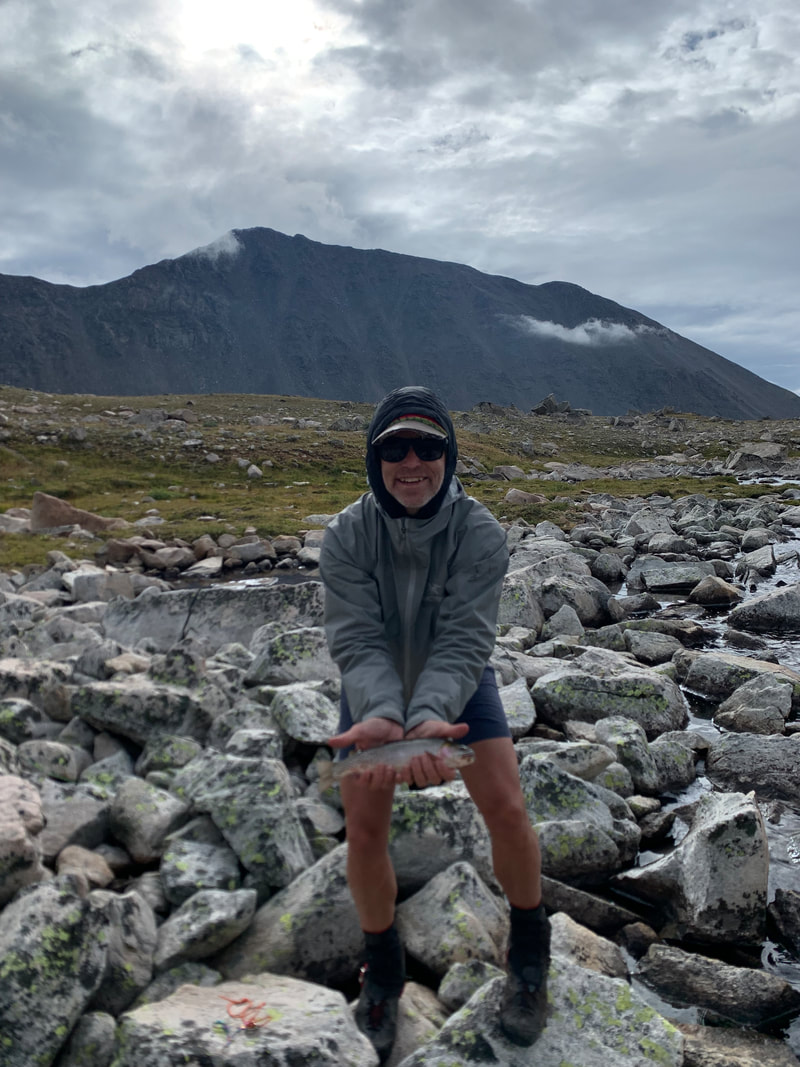
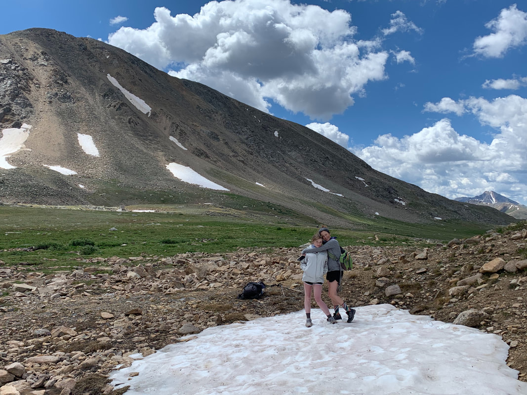
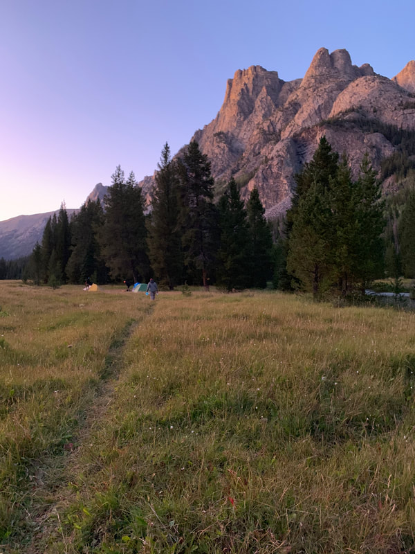
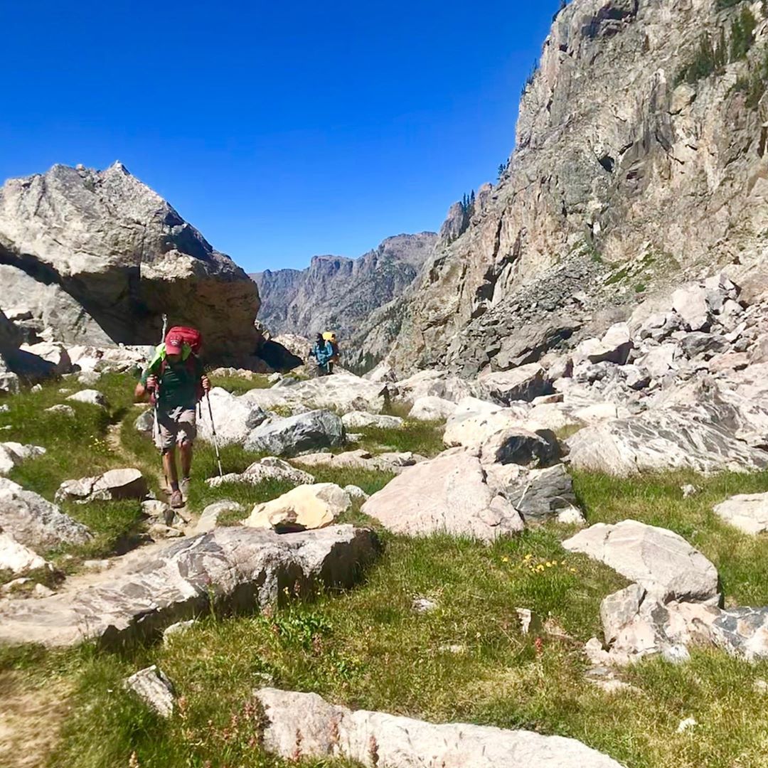
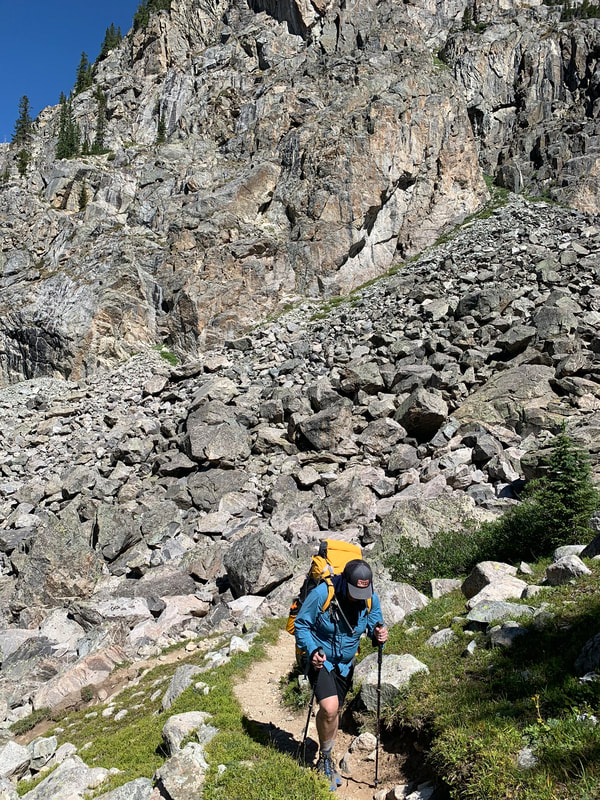
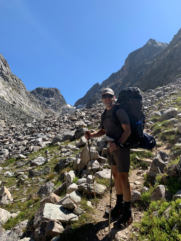
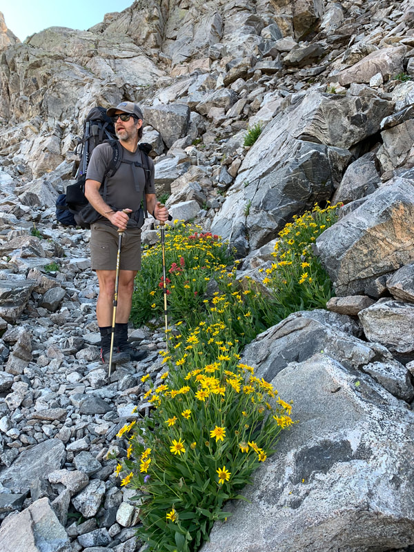
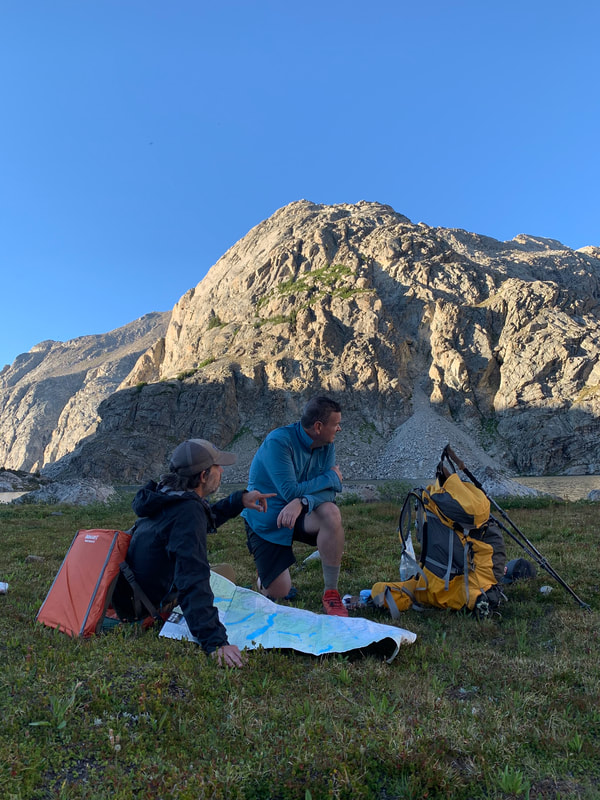
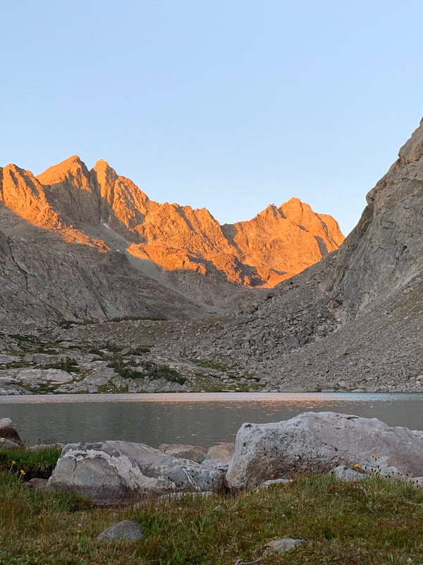
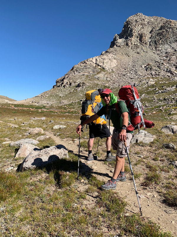
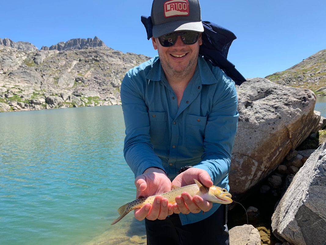
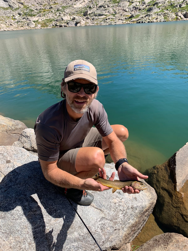
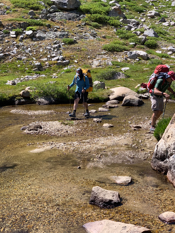
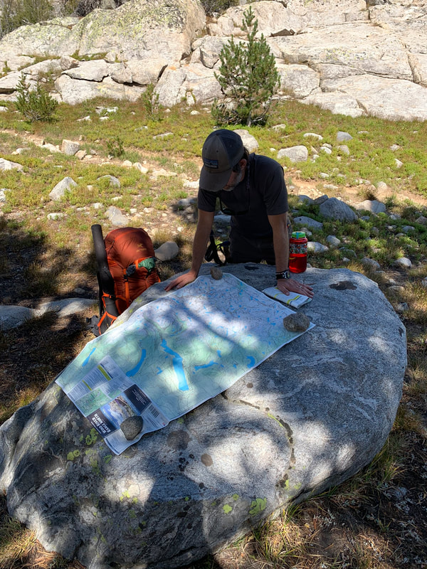
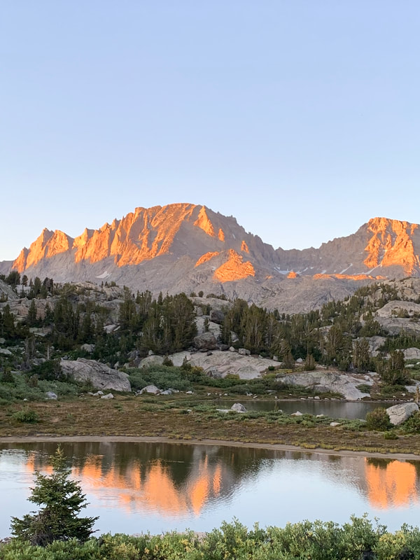
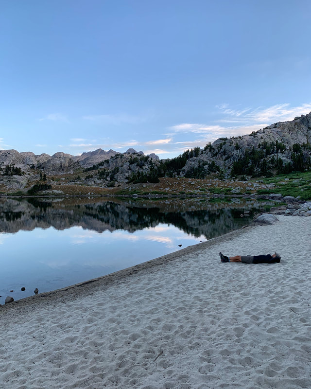
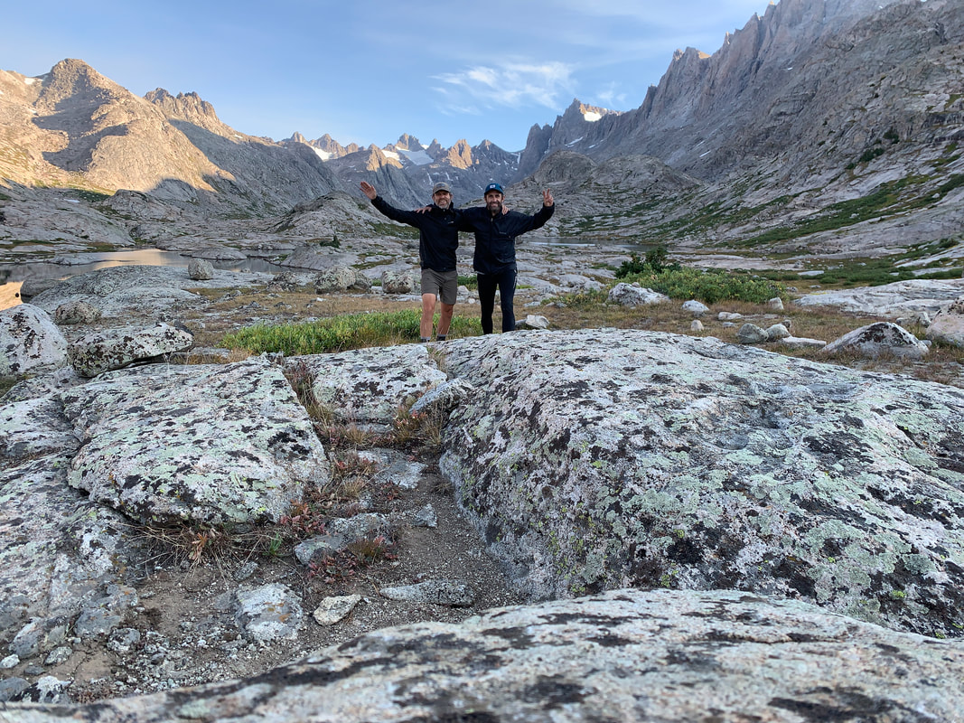
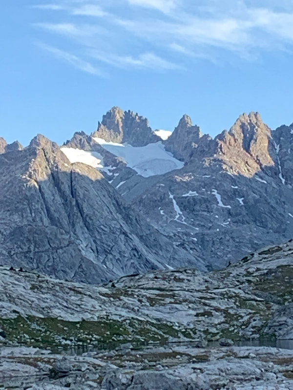
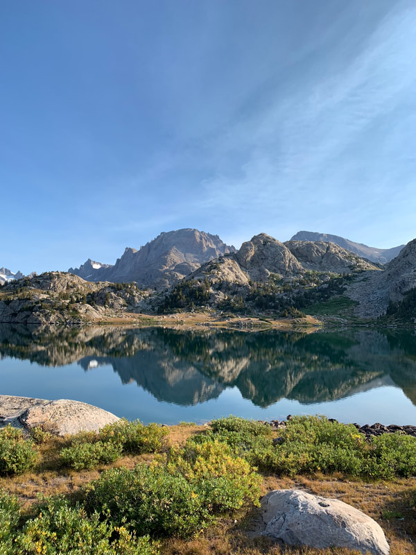
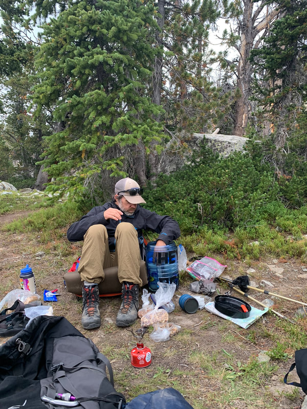
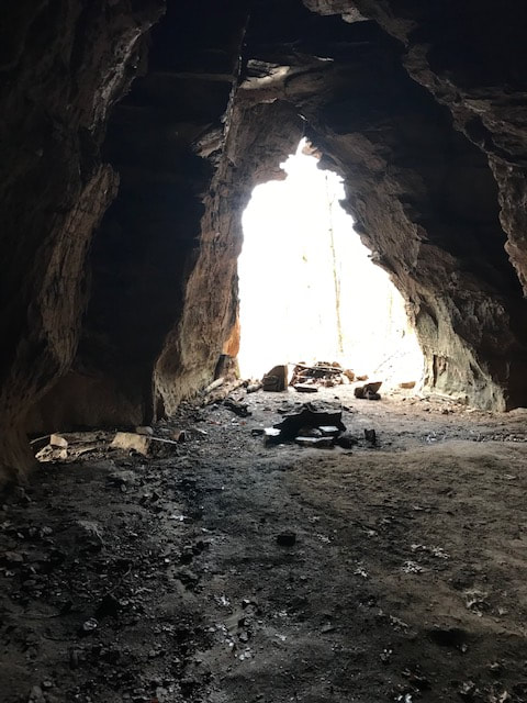
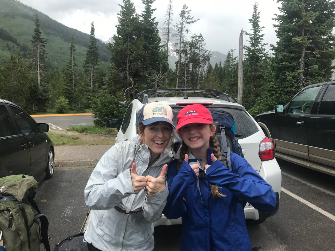
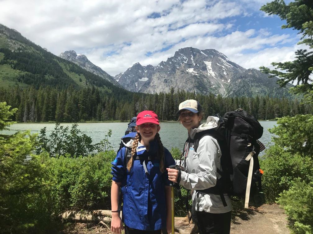
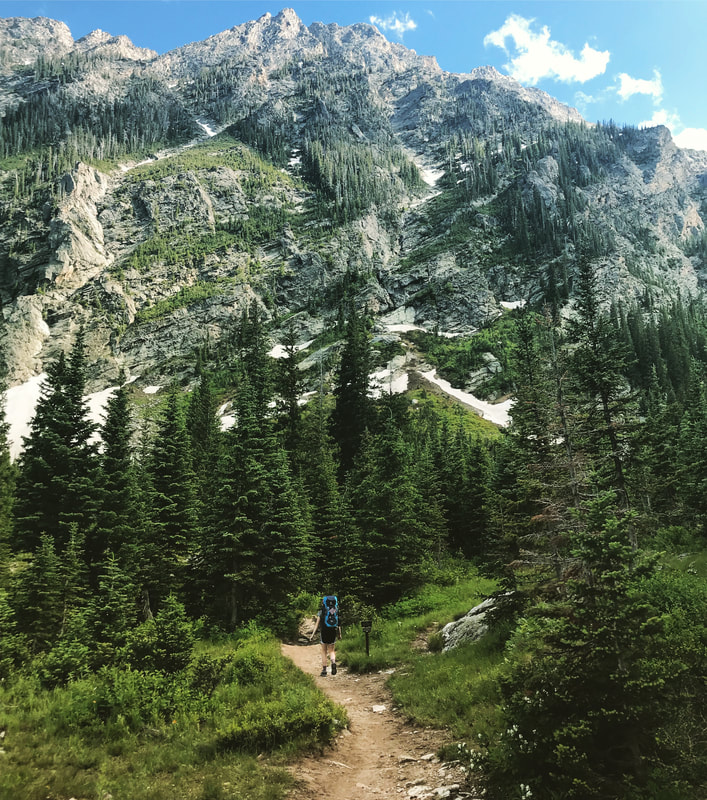
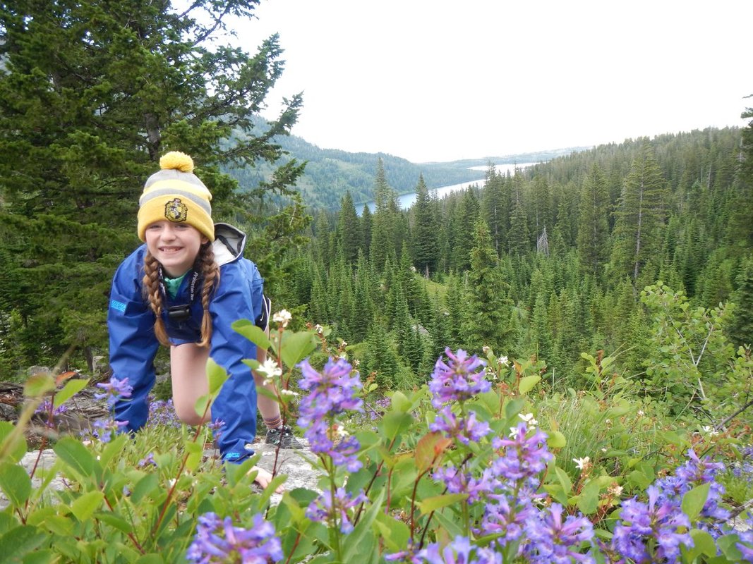
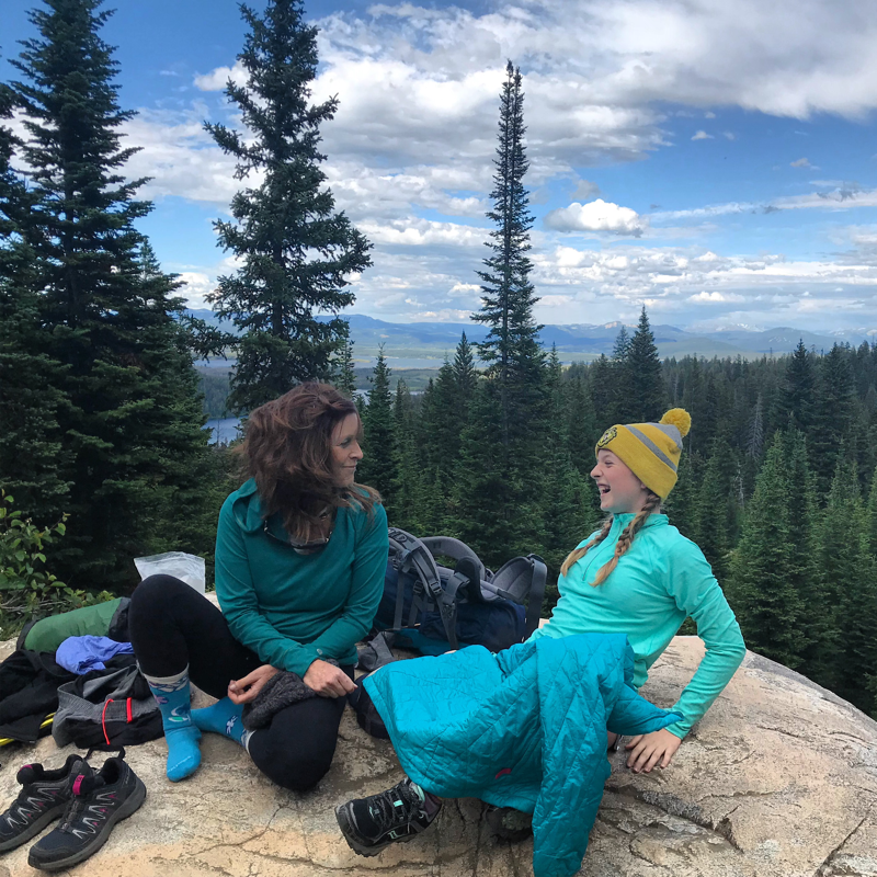
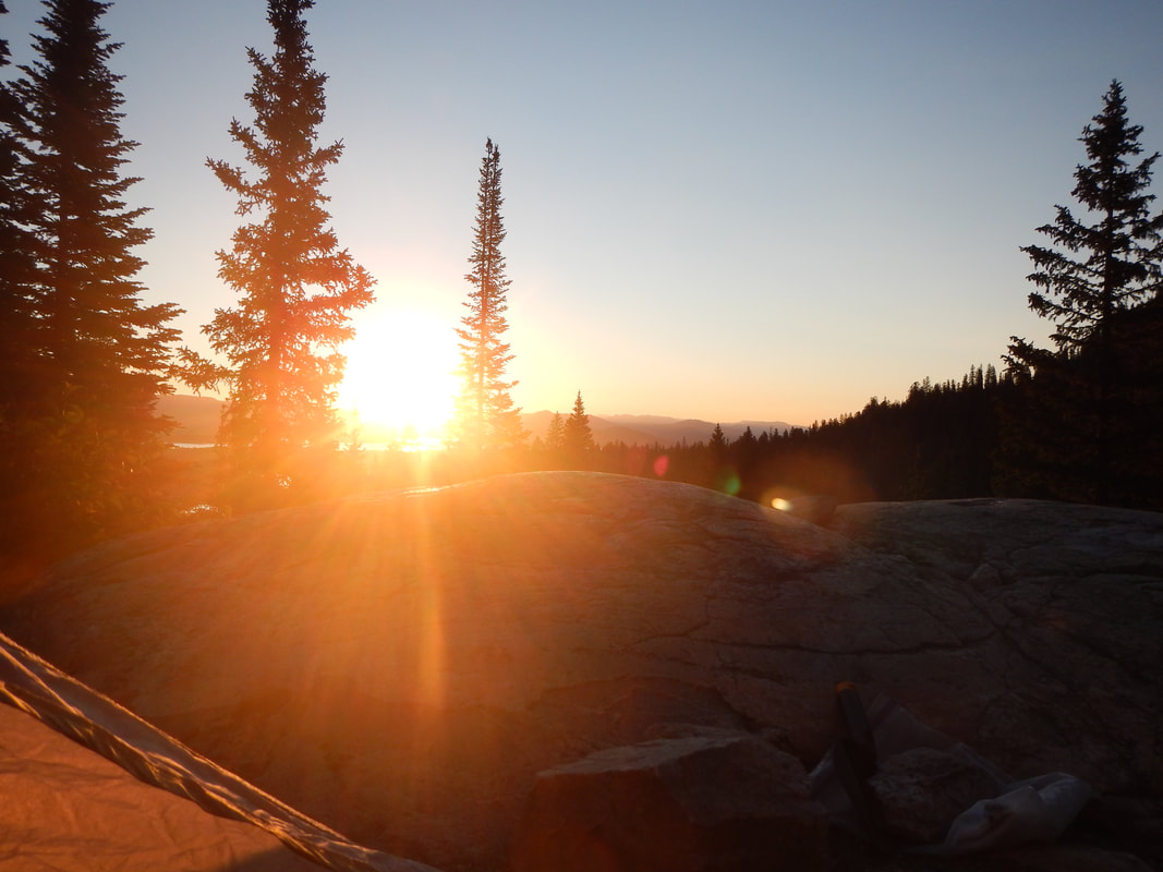
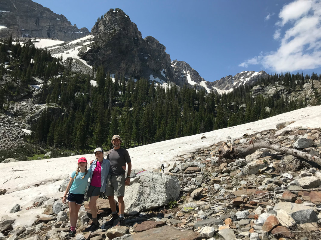
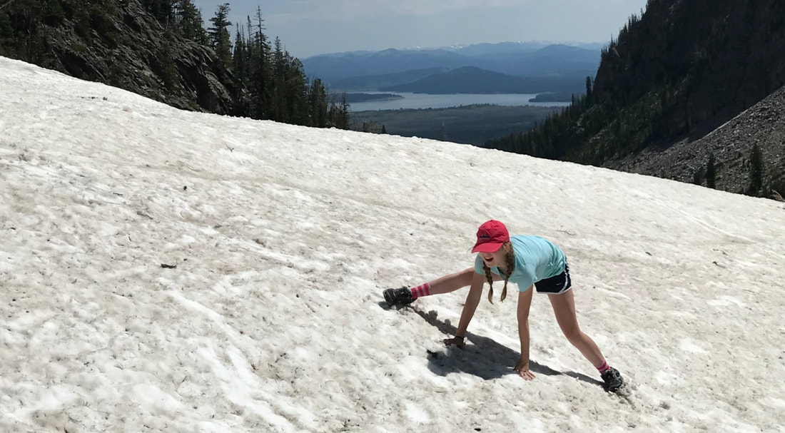
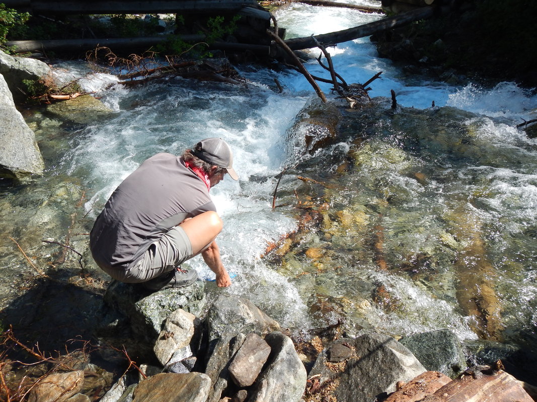
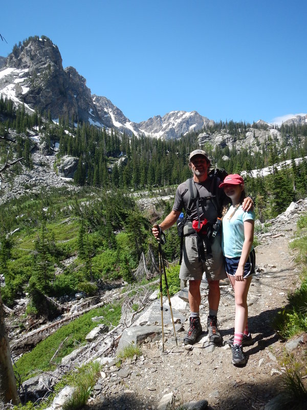
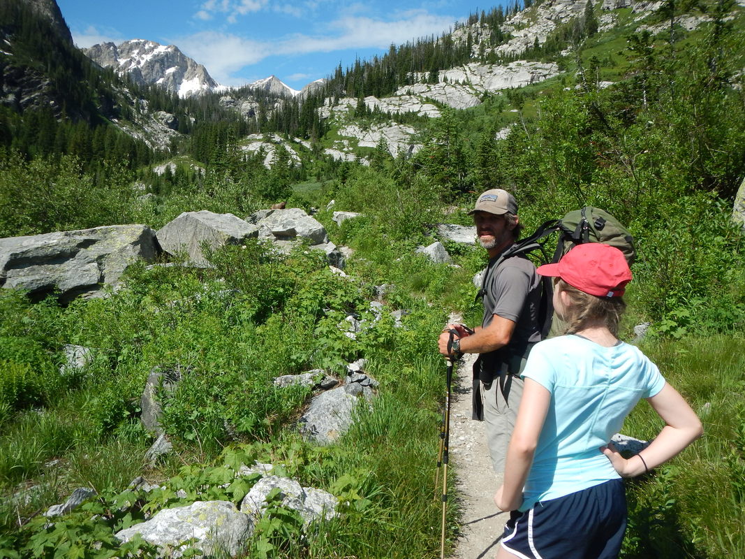
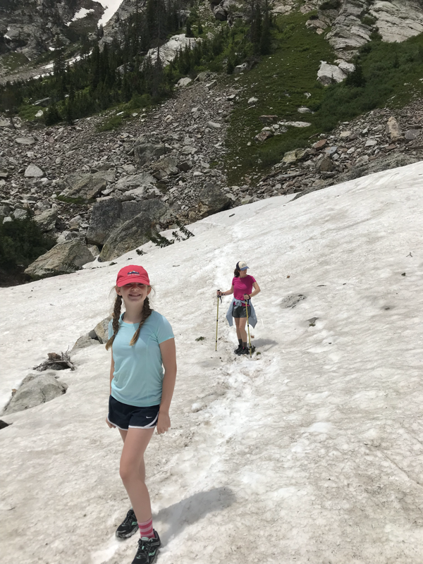
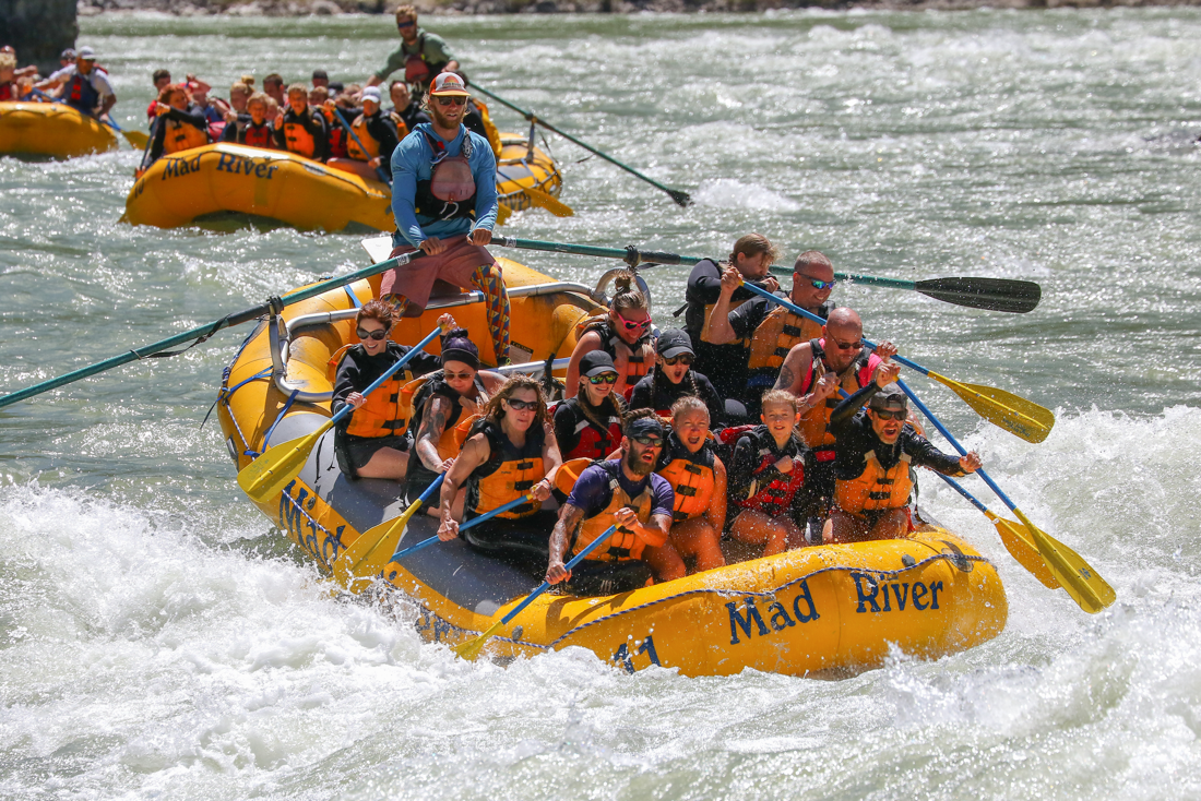
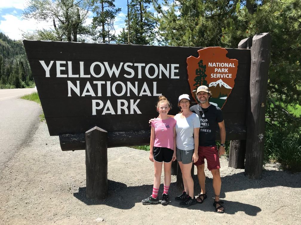
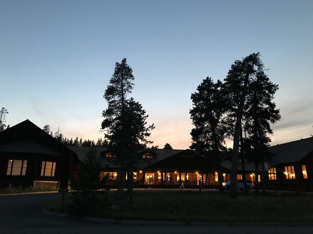
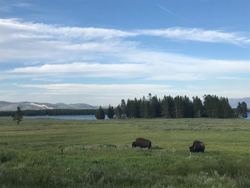
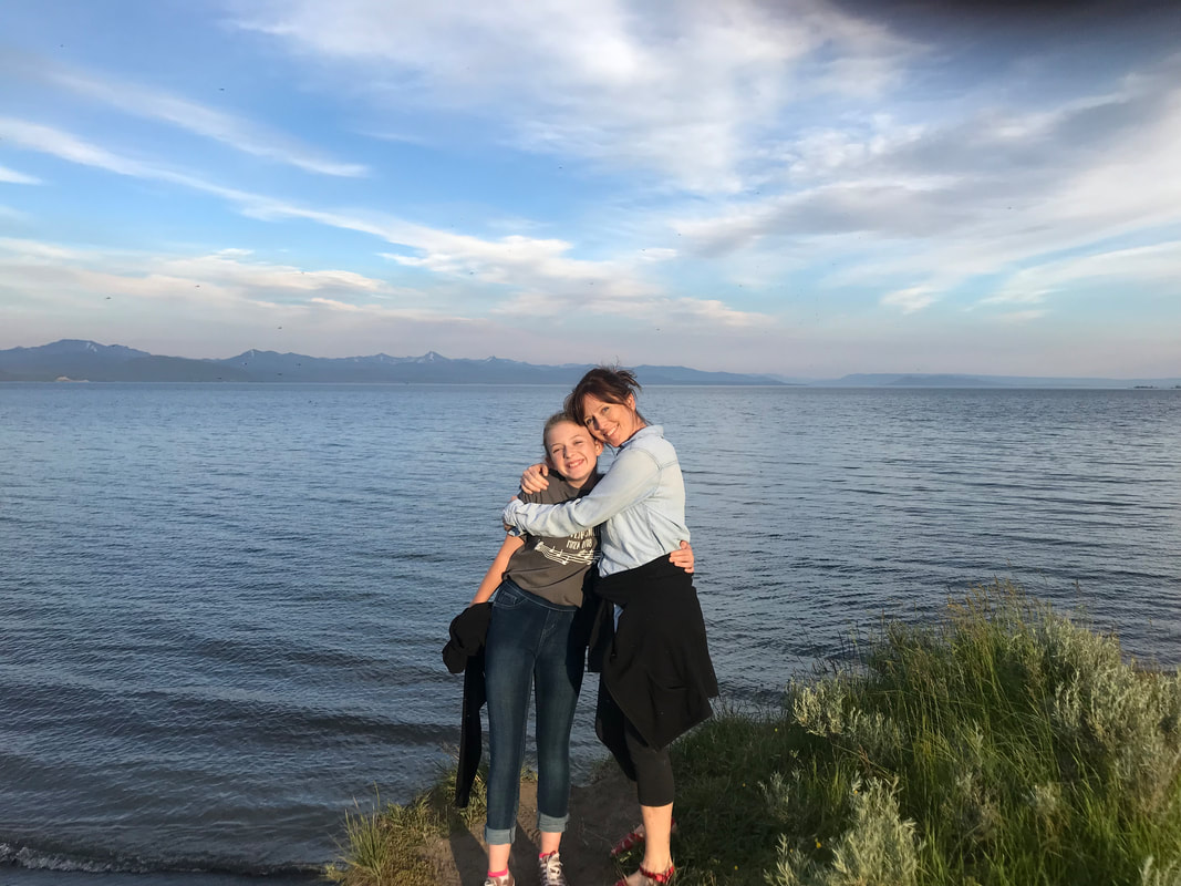
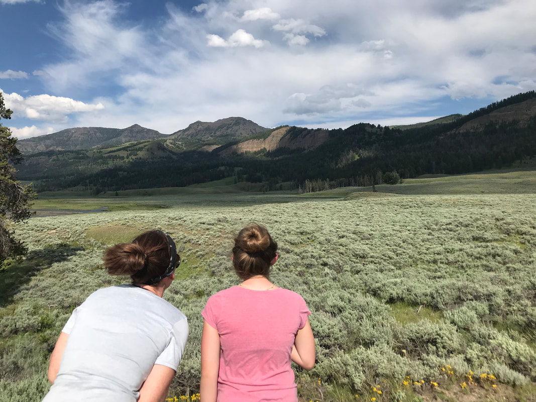
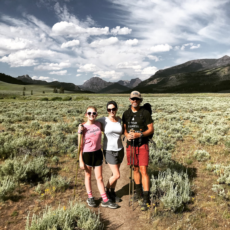
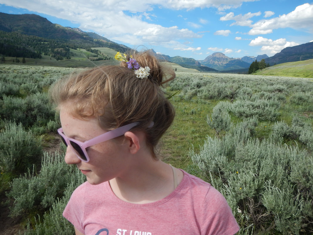
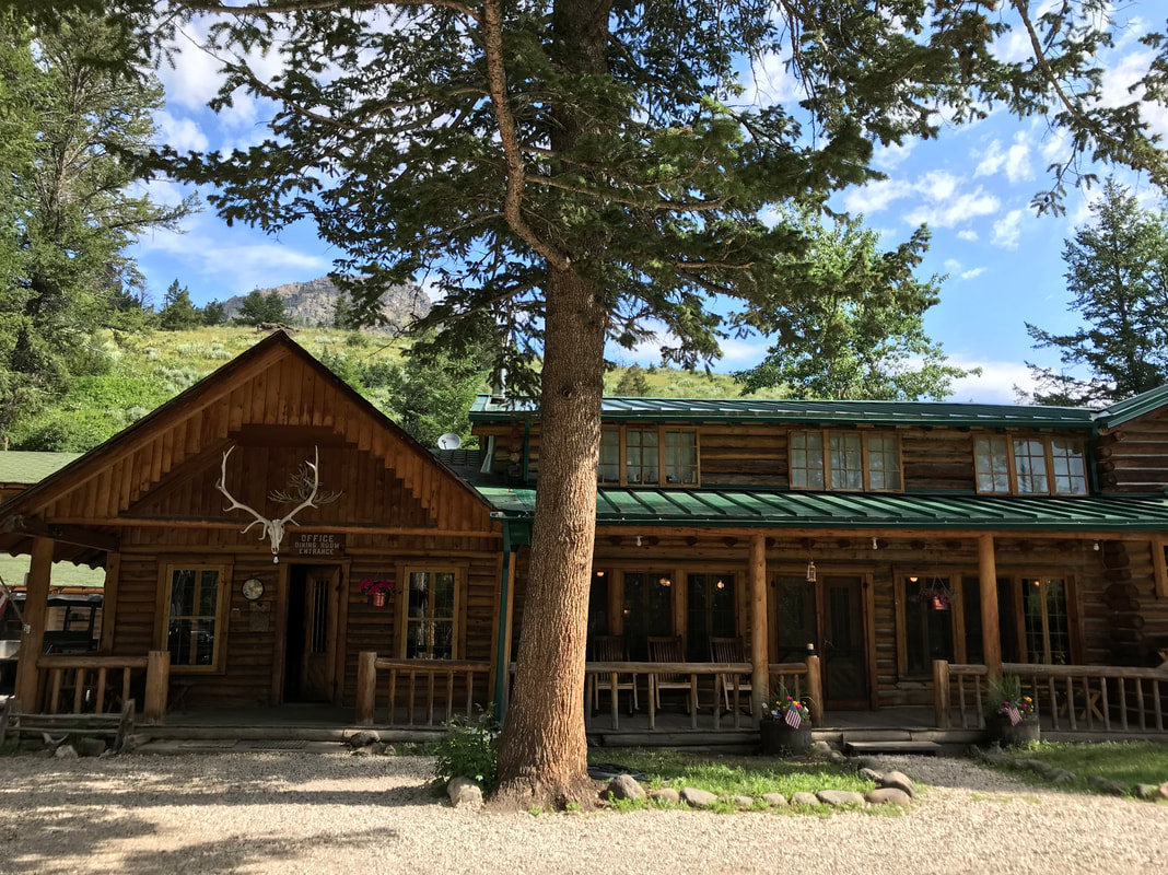
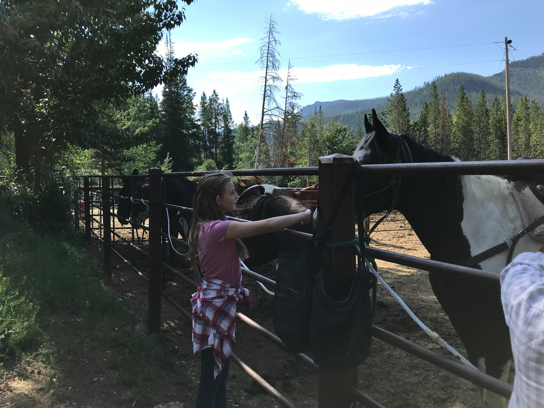
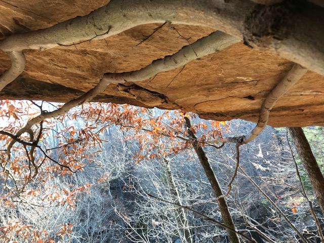
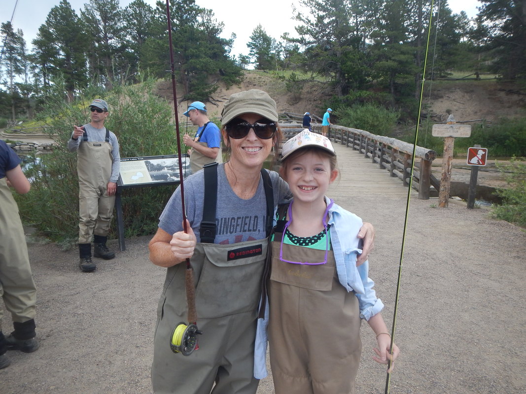
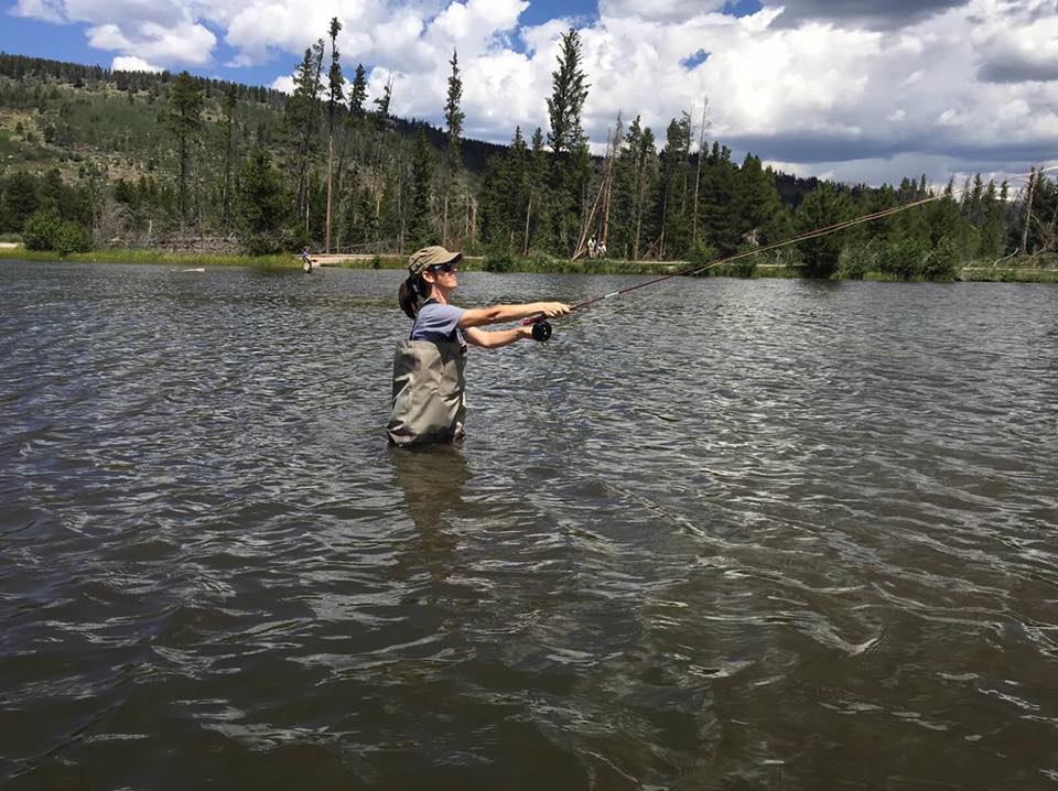
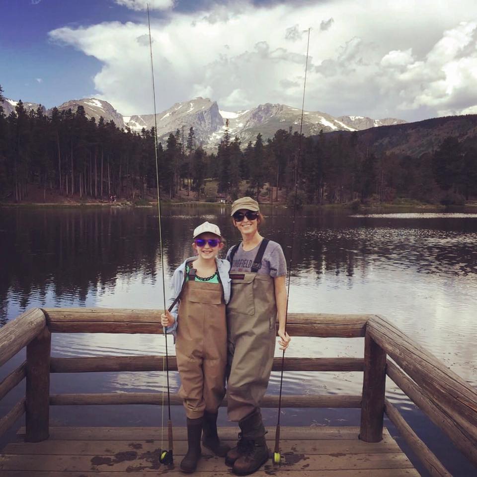
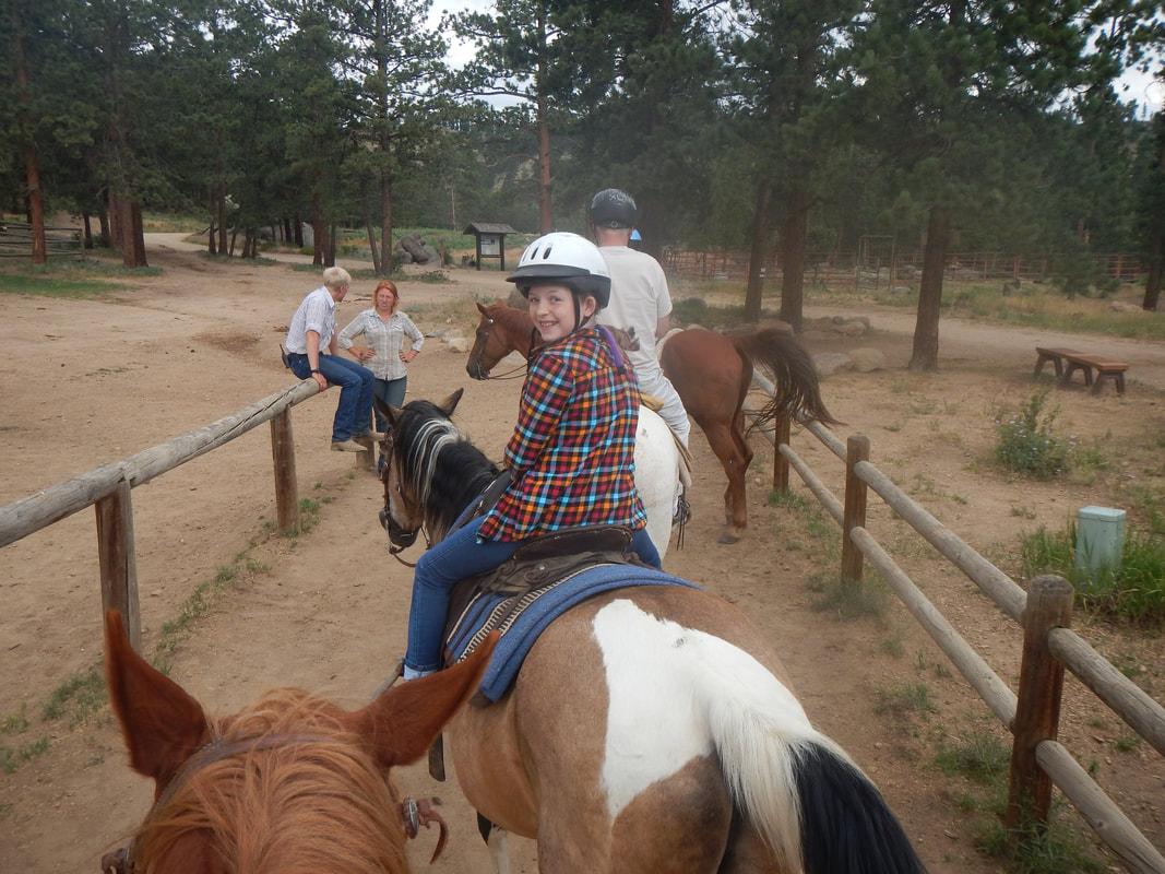
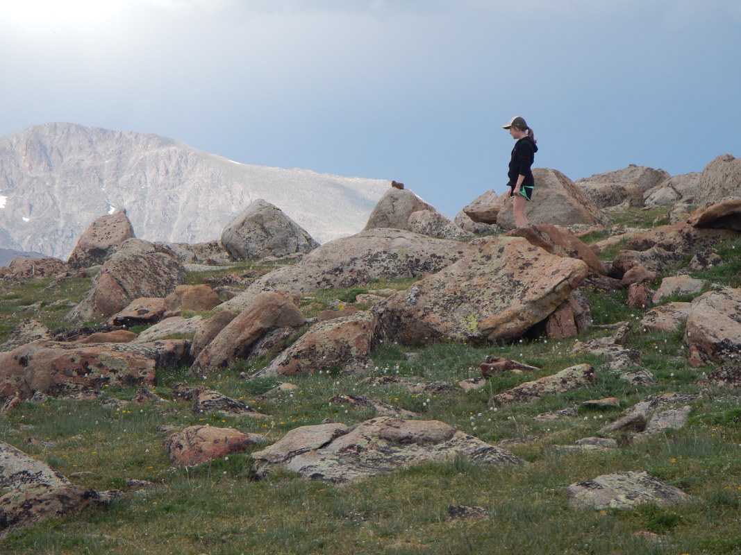
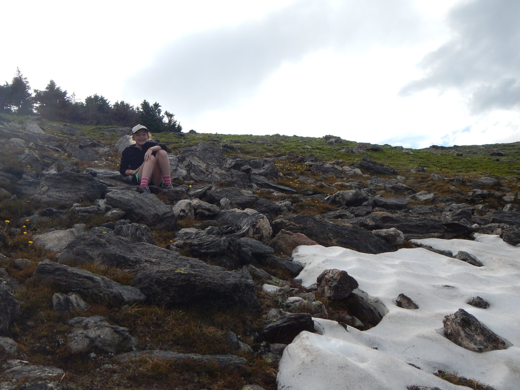
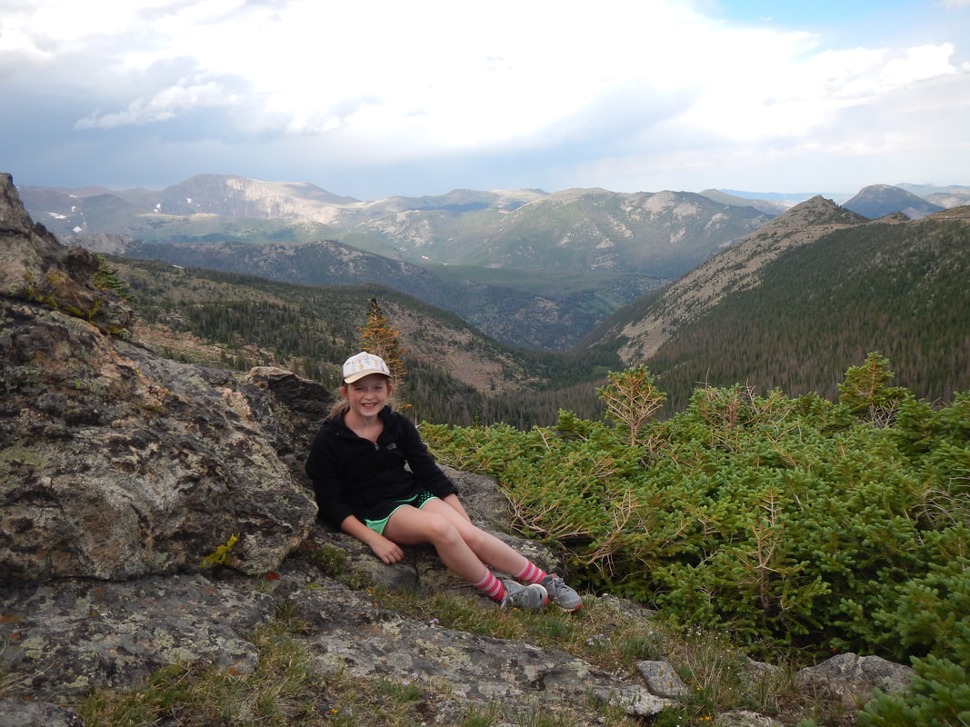
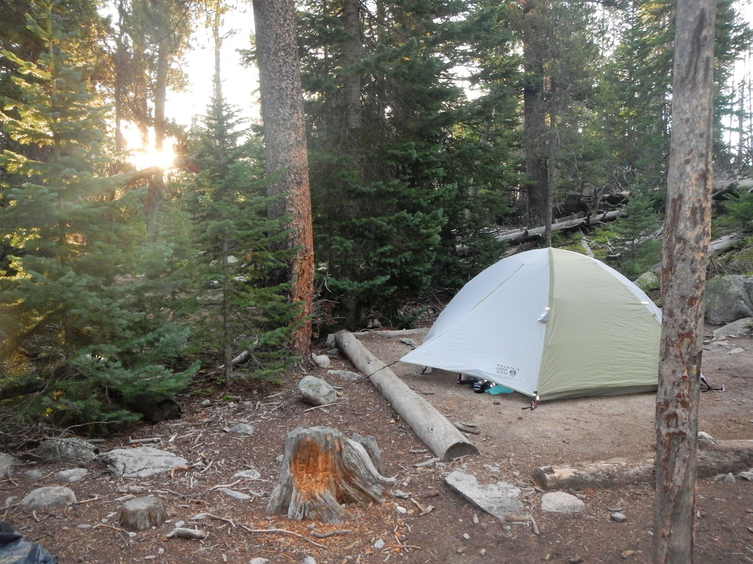
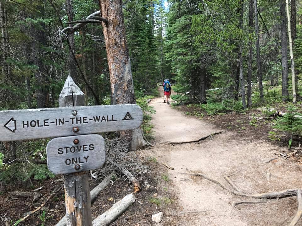
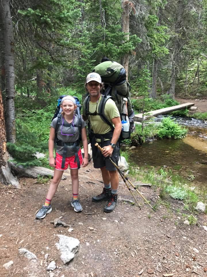
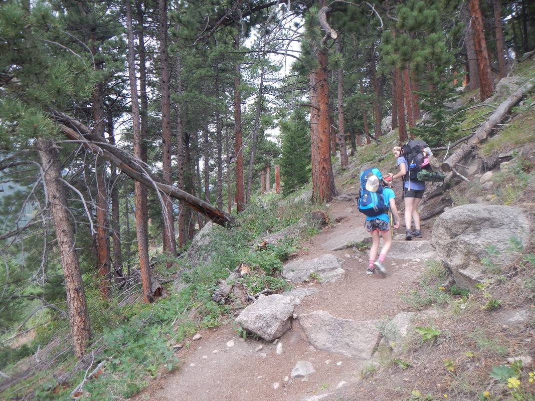
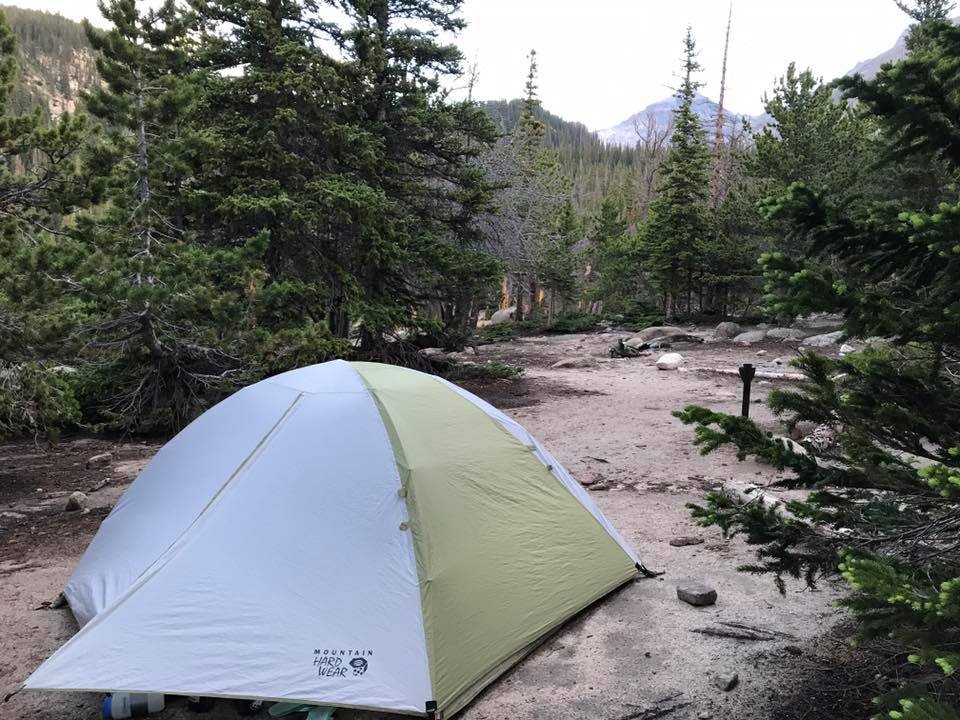
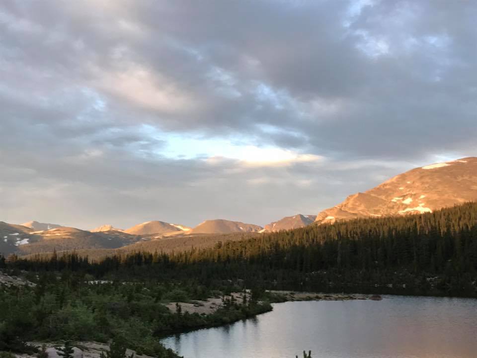
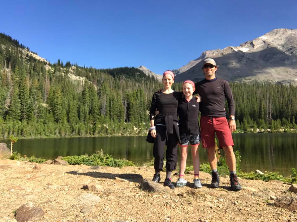
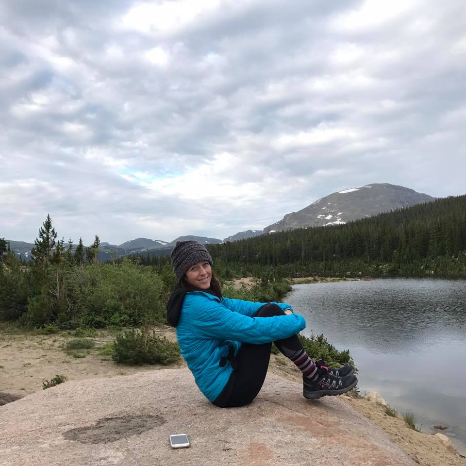
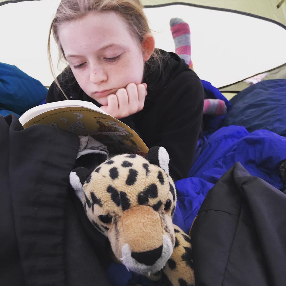
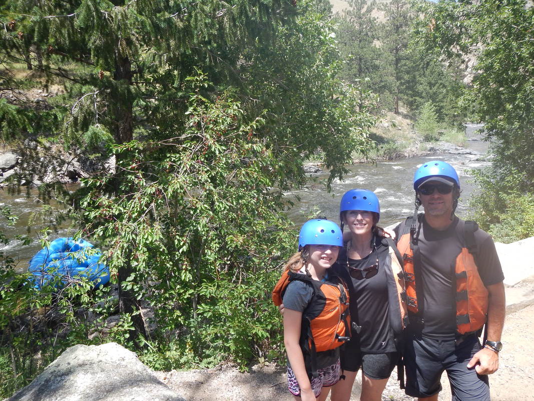
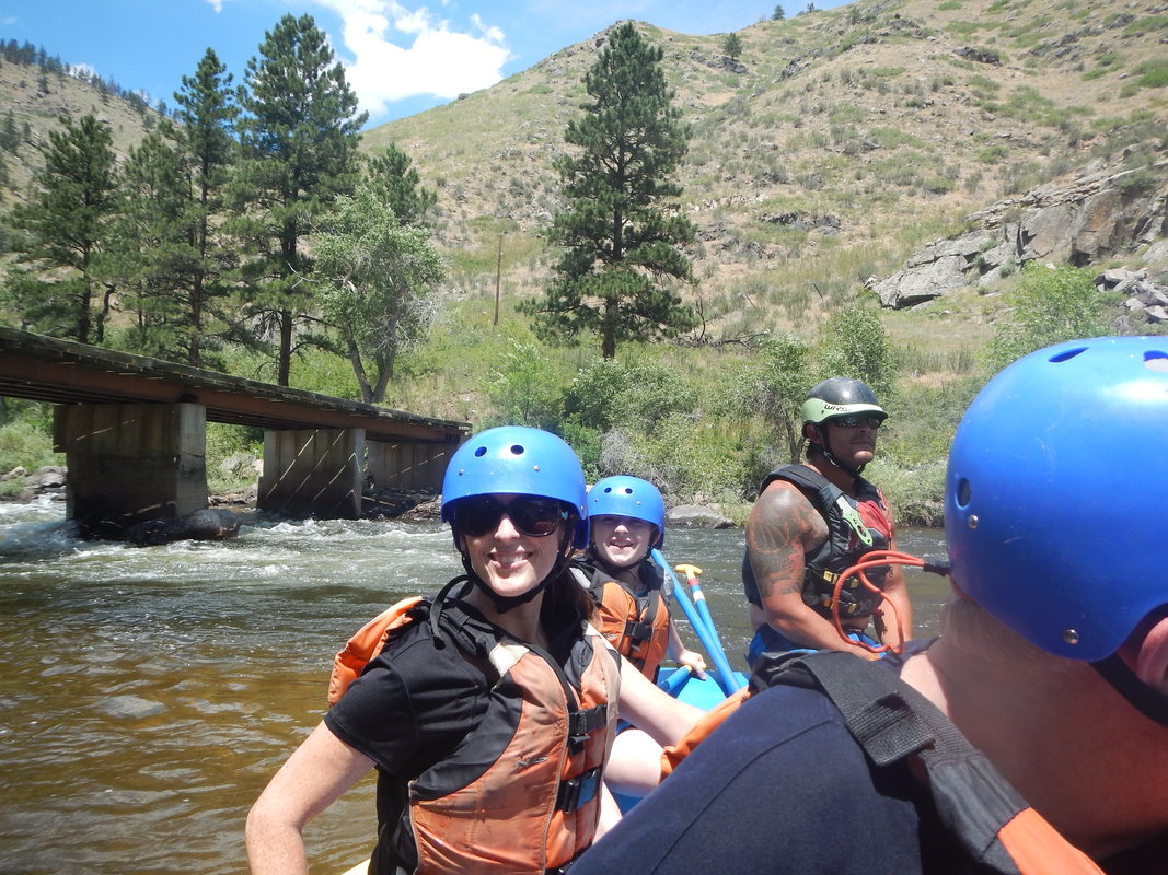
I put together a 5 day outing starting at the Green River TH traversing to Peak Lake, Over Knapsack Col and exiting via Elkhart Park TH. It's a bit of a drive from Missouri, but we made it! We spent a night at the Log Cabin Motel in Pinedale Wyoming. Charming is the best way to describe our 3 room cabin in the middle of Pinedale that was built in 1929. An easy walk to the local brewery. Thelogcabinmotel.com . As we drove from Pinedale to the Green River Lakes TH the increasing isolation was evident and the chill of the air seemed to increase despite the warmth that shone from the sky. After one last bathroom lake we donned our sunscreen and took our loaded packs from the truck, with one last "umph" we hoisted our 40 lb packs for the initial 11 mile walk to three forks park where we would set up camp. Day one: Green Lakes TH to Three Forks, 11 miles. We spent most of the day staring at the wonder of square tip mountain, the very blue hue of Green River and teh meadows that lay on either side containing green grasses and the remaining wildflowers. The day was beautiful but long. We found our spot at 5:30pm, watched the sun set and took in the spectacle of the night with its vibrant lights that hung above us. Day two: Three forks to Peak Lake 7 miles, 2000 ft of elevation gain. We woke to a hard frost in the valley. The stars had shown with immense intensity and the chill was just enough to make me feel snug in my sleeping bag. The grass sparkled as teh light hit the crystals taht clung to teh blades of grass. I donned my gloves and stocking cap before heading to the kitchen for some coffee and breakfast. Packs packed and loaded just as 10am rolled around. We had been greeted by a bird that wasn't the least bit intimidated by our presence. We began our day with an immediate 700ft ascent. A quick break where we met a running stream, a beautiful alpinee meadow filled with flowers and an abrupt ascent up to vista pass. Not much of a vista, but nice with some shallow ponds and what appeared to be moose tracks. Descending into a wonderful flower filled meadow complete with a nice brooke, perfect meadow and we continued into a drainage., void of color that went directly up, filled with house sized boulders and everything else we packed our walked away to navigate the overwhelming scenery for over 1 hour. Tired, warn out we traversed DAle Lake, Cube Pass to Peak Lake. Found a camp spot, cook spot and discussed how tired we were. I seriously began to doubt the route tomorrow that would include Knapsack Col. This wouild be a serious effort that would be extremely difficult following a day with over 200ft of elevation gain to 10,600ft Peak Lake. The objective of this trip is for everyone to have fun. I essentially made the decision to traverse Shannon Pass instead of Knapsack Col before I introduced the idea to anyone. I talked briefly with Kyle, but felt I needed to take it to Gabe since he was having heel issues. Gabe agreed Shannon Pass would be the best choice in his book so we went with it. With this choice came the realization that Knapsack Col and Titcomb Basin would be out of our reach. I still clung to the small hope that Titcomb Basin might still fit into our plans, but I didn't see it happening. We all sat in for the evening at our cook site and watched the sun bounce its last red rays off of the surrounding jagged edges of mountainous rock. Day three: Peak Lake- Near Island Lake The sun rose over Knapsack Col, choosing the lowest level in the range to pierce the morning shadows that kept the morning cool and teh mospuitos at bay. I crawled out of my tent to a nearby rock with my thermorest and sleeping bag to take in the morning show. Feeling the effort from yesterday, I slowley made my way down to the cooksite for a breakfast of coffee, Otameal with coco and a cliff bar. All the while mesmorized by the surroundign scenery. We broke camp by 9:30 this morning, knowing that although the elevation wa far less than we had planned, we had about two more miles to cover. Shannon Pass was our first and only pass of teh day. Approximately 700ft elevation gain allowed us to peer over Peak Lake as eh sun flooded the turqoise water. Our attention quickly turned to snow that held onto teh top of the "peak" and quenched the thirst of the tarns that show up on the map but still surprised me! The other side of the passoffered a rolling grass view. We stopped to eat lunch and take in the miew of Mt Oeneis and Sky Piolot Peak while the sun warmed us on this breezy day. Back onto the trail and soon we once again joined the HIghline Trail heading southeast toward the Jean Lakes. Richland Creek Wilderness Area, Arkansas. Since this is a wilderness area there aren't any "maintained" trails to traverse. I explored the Richland Creek Wilderness with some friends about two years ago. We followed a trail that was hard to follow, but helped with some navigation, the majority of it stuck to the edges of the water and made for some easy travel, this time was different. We traveled through some intense rain on our way to Richland Creek Campground, our goal was to set up camp before midnight. We hit an intersection in Snowball and my buddy, Kyle suggested we take a "shortcut", sure, what could go wrong. So in the spirit of adventure we head up a hill on a gravel road. I engaged the subaru and double timed the windshield wipers to disperse the rain that continued it's humdrum song on the roof of my car. As we climbed an Ozark mountain we became engulfed in fog so thick that I had to find my foglights, you couldn't see anything. A couple of stream crossings on the downhill and Voila! A long stretch of water (not moving) that had no way to tell how deep it was stretched across the country road.. I ventured in slightly, door open, marking the depth with my hand. Kyle volunteered to Chaco up and be the depth gauge, walking through the water as I followed. We made it! Only to reach a hard flowing stretch of water that submerged our road with a raging fit of noise and turbulence. Sooo.... We backtracked to the highway and found our way to Richland Creek Campground. Kyle and I chatted as the rain fell and decided to set up camp and the campground, then start hiking the following day. The storm came and went throughout the night. By daylight it was evident that we wouldn't be crossing the creek and a decision was made to take the bridge near the campground and begin our cross country trek using map and compass. We crossed the bridge, found a shelf and began your regular map and compass traverse. The ground was soggy, slick, and covered with leaves, Due to the creek flowing with great force, we couldn't drop down to the trail we'd traversed a couple of years ago, we had to stay higher on the ridge, this forced us to navigate on very steep terrain and small boulder covered shelves. The boulders were wet and covered with moss, making things slick as snot; and the spaces between the boulders were leaf covered, sometimes hiding deep holes in the ground. We navigated this terrain for about 1- 1.5 miles, with full packs on. Dangerous and slow was the name of the game. This lead to up to a scramble where I was on hands and knees with a full pack, scrambling up a hill. A quick lunch and look at the map lead to a plan of action that produced more of the same. Finally, with tired legs, we saw the confluence of Long Devils Fork and Richland Creek. Next, we saw three rafts make their way into this confluence and stop at and established campsite across the creek from us. Some quick waves from the local paddlers and a thumbs up gave notice that we were ok. At this point, we were very near our destination of Twin Falls and the water was easing. We started up the creek toward the falls, even traversing a wet rock ledge a few feet above the creek with out much room to move, a few handholds and water dropping onto us from the ledge above. this lead to a beautiful view of the falls where Long Devil's Fork and Big Devil's Fork met to create the twin falls. Without anywhere to go we found ourselves in a dead end and we began to prepare for a wet crossing. The flow of the water was still intense so we pursued plan B, and decided to climb the steep hillside. Once again, I was on hand and knees, sliding down a precarious slope and reaching for roots, rocks and anything solid to stop the slide. Standing above twin falls and our campsite in view across Big Devil's Fork, we began looking for a safe place to dip our toes into the cold water without being swept over the waterfall. Donning our Chacos and unbuckled packs on we made our way across the drainage on to our campsite. We slept well to the sound of roaring water. A chili morning with mist rising from the thundering falls created an orange sunrise amongst the moist air. My tent and sleeping bag are heavy with condensation. The totality of sleeping between two waterfalls. We looked at the map once more while firing up the stoves and taking in some coffee. We decided to return to Richland Creek Campground by heading past the Sandstone Castles, then walking out a well used trail to the gravel road that surrounds the wilderness area. It was interesting to find these "Castles" carved out in the cliffs. There were a few that could hold a some tents, but had water on the floor. Our 12 mile walk back to the campground was worth avoiding the stone filled traps that we'd navigated the previous day. Yes, We will be back. Grand Teton National Park, Paintbrush Canyon Trail- Grand Teton National Park has a certain amount of backcountry campsites throughout their park that need to be reserved. The reservations aren't specific, they relate to camp zones, not particular campsites. Luckily they also hold a certain amount of reservations back for those that walk in and intend to begin their hike within the next 24 hours. Intent on obtaining a backcountry permit for our backpacking trip, I woke the family and we drove to the Moose visitor center in GTNP to line up for a backcountry permit. We arrived before the visitor center was open, adding to the line that had already begun to form. We were able get a permit on 7/3/18 for the lower paintbrush canyon camp zone and a permit for the upper paintbrush canyon campzone on 7/4/18. The information from the park rangers said there was significant snow at Holly Lake and portions of the Upper Paintbrush canyon camp zone. Ready for an adventure, we went with it. We arrived at Leigh Lake TH and started pulling our packs out of the car. The sky's began to darken as we prepped for our departure, the rain began to fall just as we tightened our packs, it was raining hard enough for us to take off our packs and put on our raincoats, then packs on our backs once again and we were off. The first .8 miles of our hike circumvented string lake to Leigh Lake. It was flat with numerous people on the trial, but there were amazing views to be had of the Teton Range. We stopped to take a picture with the mountains in the background, this also gave us an opportunity to remove our rain gear since the sun popped out and the precipitation had ceased. Once we were ready to proceed with our hike we ran into a volunteer park ranger. She informed us that she was from Boston and asked to take our picture since we had little American flags strapped to our packs in honor of the Fourth of July. We talked about our trip plans and the volunteer ranger informed us snow travel was very difficult on the last portion of the trail to the Upper PB Canyon campzone. I informed her that I had wanted to stay in the Lower PB Canyon camp zone for both nights but that wasn't an option when I acquired the back country permit. The park ranger said she could change that and asked for our permit, she wrote on it and Voila! we had two nights in the Lower PB Canyon Camp Zone. By the end of our conversation with the Volunteer Park Ranger we had numerous mosquitoes extracting blood from our legs, so we applied Deet before taking off once again. The trail wasn't too bad, a fairly easy ascent most of the way. We stopped at a beautiful waterfall of snow melt for a breather, soon after the waterfall we entered the lower PB camp zone. We looked at the 2nd camp area available, it was a very nice spot with picturesque views of the mountains; we arrived at this camp spot at about 5pm so we decided to make camp. As we started putting up camp some mosquitoes started bothering us, and when we began making dinner it was evident that the mosquitoes would be relentless. After dinner we tried to enjoy our surroundings, but the mosquitoes drove us inside our tent. There Sophia and Kelli took turns reading a book Sophia brought for some good entertainment. That night, Kelli had ventured out of the tent. She prompted me to come outside. I stepped out to take in a sky full of stars that called to us from the Back Country. The moon lit the steep mountain face that bordered us, the air was refreshingly frigid and the bugs had gone to bed. these are the moments I live for. 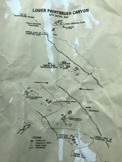 The following morning I unzipped my tent door allowing a rush of cold air to enter the tent and a blazing sun peeked over a rock to greet us. I pulled my thermarest and sleeping bag out of the tent and perched on the nearby rock. The mountainside with its white snow and speckled colors of wildflowers lit up with the rising sun in a light I have only seen in the mountains, almost glowing in a radiant light. While Sophia and Kelli got ready for the day, I went to the kitchen area and prepped food. I was getting ready to go back to the tent when something caught my eye; a yellow bellied marmot. The next thing you know, like magic he pops up next to the kitchen. I shooed him away and watched him make his way down to camp. I told Kelli and she took action, making sure our gear was safe. The Park Ranger at Moose informed us that these critters like to eat the salt from trekking pole handle and backpacks! We discussed plans for the day, the previous evening was so relentless with mosquitoes that we decided to hike out after a day hike to upper paintbrush canyon camp zone. I carried snacks, 1st aid kit, water filter and layers, then we were off. The day was filled with incredible scenery. As we gained elevation forests thinned and we entered the beginning of alpine country. We crossed a scree field covered with snow, adventured into canyons with edges rising brilliantly over us. All the while the sound of rushing water filled our ears as new snowmelt created crystal clear trickles, then streams that turned into rushing white water. I can't find the words to convey the beauty that surrounded us. After about 3 hours of hiking and playing we turned back, 1 hour later we were at our camp. Everyone was feeling pretty good when we returned to camp. It was much hotter when we reached the lower elevation (approximately 7,600 ft) The mosquitoes were beginning to make their appearance once again, so we packed up and headed out. The long day of hiking accompanied by the increased activity of the mosquitoes began to take its toll. We finished the hike, returning to the Leigh Lake Trailhead feeling a sense of accomplishment and embracing the beauty from which we had just emerged. Our whitewater rafting experience was wonderful. We used mad-river.com for our guides on the Snake river. They were located in Jackson Hole, made it super easy to get what we needed and the features on the section we took were thrilling. The flow was moving at 1200 CFS and we tackled some class III water. I was in the front paddling and Sophia decided to join me, Kelli rocked the back with a paddle in hand. It was a great adventure and we got soaked from the get go. Luckily I had rented a wetsuit top and Sophia had a top and some booties. Up front, we didn't get just wet, we got drenched. Some of the rapids were Lunch Counter (the biggest), ground meat and Champagne. We spent the rest of the day laughing about the thrills and lounging in Jackson Hole. On to Yellowstone! After a quick stop at a rest area for a PBandJ sandwich we made our way to Old Faithful. I really wasn't feeling it, the parking area was huge and packed! The whole situation had a Disney type of feel, but when we approached the geysers with their steam, crust of mineral and bubbling water, I quickly embraced the other worldly feel of this natural treasure. Old Faithful went off just about as predicted, this impressive also, glad to experience this one. Next we traveled to Grand Prismatic. The incredible colors, steam and the surrounding landscape was beautiful We spent our nights and evenings at Lake Lodge. We rented a cabin that was a short walk away from the main lodge. The accommodations were clean and met our needs. We spent the evenings taking advantage of the Lake Lodge porch, overlooking Yellowstone lake and the Absoroka Mountains in the distance. Every evening we were greeted by two bison that walked through the field in front of the lodge, almost on que for the sunset. Lamar Valley turned out to be a wonderful day hike. The landscape was almost too immense to comprehend. We saw many buffalo and a black bear that was safely in the distance. This was one of those places that I wish we could have spent more time exploring and finding out what was on the other side of the various mountains surrounding us. Shoshone Guest Lodge and Ranch, Shoshone National Forest, just outside of the Yellowstone east entrance. https://www.shoshonelodge.com. Horseback riding is always on the agenda. We decided to use Shoshone Guest Lodge and Ranch. We booked a two hour ride, but arrived quite a bit earlier than we needed to. No GPS in the mountains, so weren't exactly sure how long it would take us to get there. Since we had a little extra time we ordered breakfast before our adventure and what a fantastic breakfast! The staff was very kind and helpful. We ventured down to the horses and greeted them. Soon we were joined by other adventurers and asked about our experience with horses. One of our leaders, William, gave a great introductory lesson about how to work with the horses. The horses we rode was based on our experience and the horses temperament. I rode "Drummer", Kelli rode "Otis" and Sophia rode "Trixie". The trail was in the Shoshone National Forest providing some excellent views. What a trip full of adventure! This was Sophia's first trip out west, and first time to see the mountains! I was so excited to introduce our daughter to the Rocky Mountains. I wanted her to experience the difference in the air, new ecosystems and the grandeur of the glorious mountains. The schedule was full from day one. We arrived at YMCA of the Rockies on Sunday afternoon. This turned out to be a splendid place to stay. First of all, they don't have tv's in the room, I was enthusiastic about this one, second, the wifi is spotty and its difficult to get texts out, OK with this too. I also liked the ability to use their pool, volleyball court and some other amenities for free in addition to paying a small price for art supplies in the art room on a very rainy day. The YMCA endorses a couple of companies that we used, including whitewater rafting with rapidtransitrafting.com and flyfishing with www.sasquatchflyfishing.com, we had a great experience with each of the outfitters. Our first adventure was family fly fishing with sasquatch. We were outfitted with waders, boots and fly rods. We traveled to Sprague Lake in RMNP for where we wet our lines. The staff was energetic as they took their time to teach my daughter how to cast and they gave my wife some good pointers, now she doesn't snap the fly off the line. Me and two others went with our guide to a small stream that was an outlet of Sprague Lake. We spent time chasing Brooke Trout and Rainbow. Our guide did a nice job of getting us into some fishing and letting us know his thoughts about what fly should work. After the fly fishing excursion, we drove to a high elevation trail in RMNP. We took in some breathtaking views on the UTE trail. Only oncoming storm clouds chased away from this experience. We followed up the fishing excursion with Horseback Riding. This excursion began on the YMCA grounds and traversed into RMNP. I was surprised to learn that the YMCA of the Rockies was their prior to the 1915 creation of RMNP. The last three days of our trip we spent backpacking in RMNP. It was a great trip filled with elevation, rain, hail, bear markings, a high altitude lake and tremendous scenery. We began our trip in Wild Basin at the Sandbeach Lake Trailhead. The gameplan for the first day was to hike 2 miles to hole in the wall campsite. We arrived at the trailhead at 3:30, just in time to watch a storm roll in, so we thought we'd give it a little time to pass. By 4pm it looked like we were good to go. So we hoisted our packs and began the 2 mile trek. Beauty surrounded us as we made our way through Aspen groves and Pine stands, the distinct smell enveloping us as we passed through one to another. The elevation gain was noticeable in difficulty and in our views, getting more wide open once the curtain of trees separate from each other. Rain began to fall on us, and the clap of thunder caused us to head to a safe place. We patiently waited for the weather to pass under an ENO rainfly, chomping on snacks in the theater of RMNP. It took about 2.5 hours before we arrived at Hole-In-The-Wall backcountry campsite. The campsite was near a stream and quite pleasant, although a bit buggy. We set up our tent in the designated area. We placed our kitchen on a ridge overlooking a valley with a nice breeze to disperse the mosquitoes. We all were in good spirits as Sophia munched on her ramen noodles and I cooked up some red pepper and chicken for fajitas. We celebrated our day by handing out some awards at dinner. Kelli won the award for toughin out the hike an Sophia won the award for dealing with new adventures in an upbeat way. She took on rain, bugs, hiking and a significant elevation gain in an upbeat way. Nice expedition behavior. 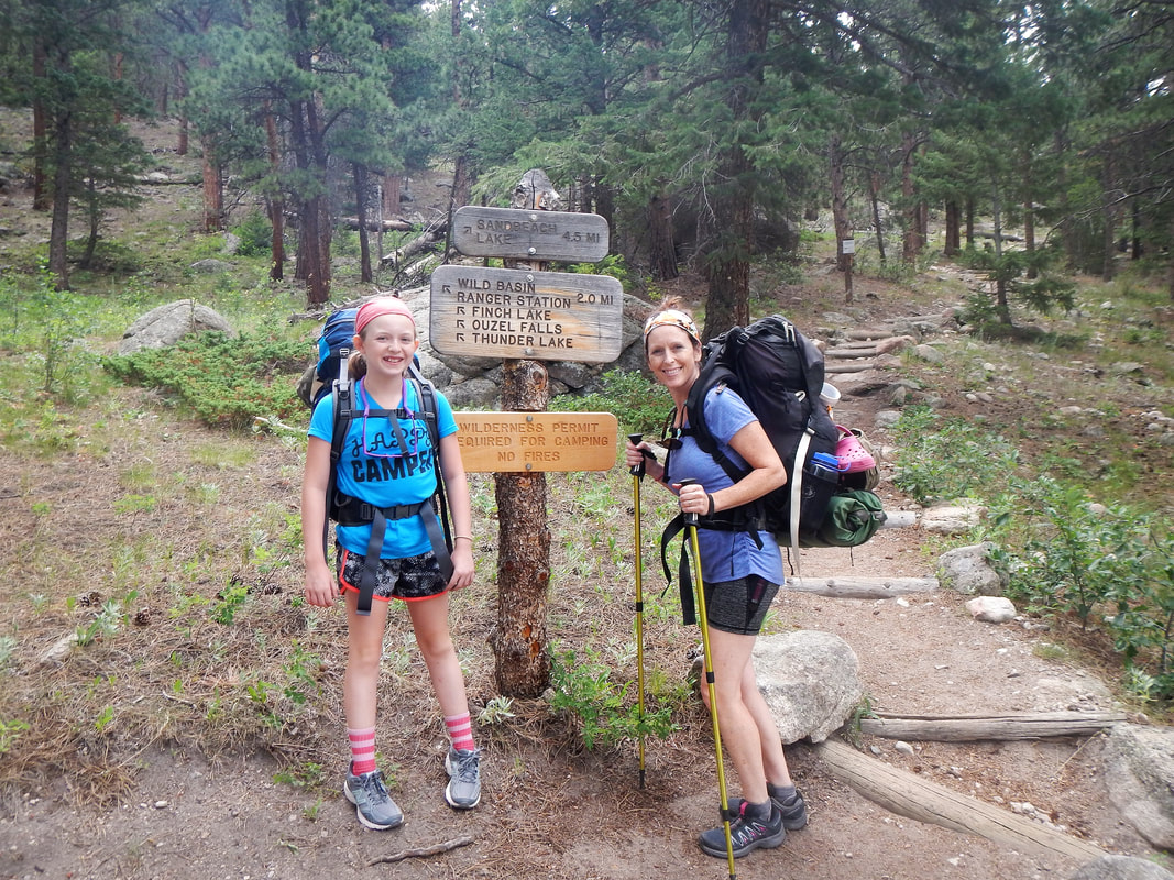 I woke at hole-in-the-wall before Sophia and Kelli. I ventured to the ridge and took at look at the valley view, checking the cooksite as I went. I spent a good deal of time reclining on the ridge, watching the sun rise and taking in the warm glow. Eventually I took the drahm down to the creek to get some water for breakfast. On my way back to the cooksite, I took a moment to watch some menacing clouds, when I turned around a large elk with a handsome rack was on the trail. He quickly took off down the hill, but stopped to return my stare. With a flash he was gone and continued down the hill. Kelli and Sophia began to stir and started get ready for day, as Kelli began packing the sleeping bags, I started prepping for a simple breakfast of oatmeal and coffee. The topic of conversation at breakfast was about how quiet the night was, no crickets, locusts or whipperwills, just the rushing of wind through the mountain tops until morning when the birds began to warm the woods with their music. To our surprise, we were buzzed by humming birds as we ate breakfast! It was 11:00 am when we began our two mile trek to Sandbeach Lake. The trail was steep and difficult, especially for day two on the trail. I was beginning to second my decision to hike on this trail, but my late action limited the backcountry campsite availability. We continued on for a couple of tough hours when we crested a hill and Sandbeach Lake was visible through the trees! We had just enough time for a brief celebration, then the rains came. I set up the ENO rainfly where Kelli and Sophia took refuge and consumed some calories. I looked for an appropriate camp and cooksite. It rained hard, and in a brief respite, I set up the tent. Thank Goodness because for the next three hours it rained hard! We set up sleeping bags and thermarests, Sophia read her book and at one point we all took a nap. Eight pm and the rain finally stopped. It was still light and we started dinner. A fantastic version of chicken noodle soup with homemade dried veggies warmed all of us. Sophia said it was the best chicken noodle she ever had, I think it was first time she had chicken noodle on the trail. We discussed the ups and downs of backpacking , and the work it takes to acheive something special. By the time we hit the hay, we were all tired. We were greeted by a beautiful morning. The sun once again crept up a mountainside, but this time the sun was reflected in a lake. Mt. Meeker stood over us with its rocky and somewhat snow covered wall. We had time to walk and play before departing. The lake stands at 10,300ft, in our explorations we found some really cool large boulders, a pond and significant snow to play in. We packed up camp and departed by 10:30am. We had 4 miles of downhill trail to traverse. The sun was our friend all morning and for a bit of the afternoon, then it began to rain and hail. We took the usual steps to stay safe and dry. We had a great time on this adventure, all of us were full of smiles as we made our way back to Estes Park for a well deserved lunch. The Poudre River, class III rapids.
|
Categories
All
AuthorI'm your average wanna be adventurist. I spend more time day dreaming about expeditions than actually accomplishing them, but I guess life is the ultimate expedition. |
|
|


 RSS Feed